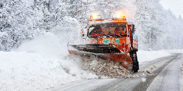
The week begins with strong winds and heavy precipitation on the north side of the Alps, with mostly heavy cloud cover. The temperatures are expected to drop somewhat in the next few days – polar cold air will cause a change in the weather from Tuesday, the Central Institute for Meteorology and Geodynamics (ZAMG) predicted.
Temperatursturz
On Tuesday, polar cold air makes a striking change in the weather. Particularly turbulent, rainy weather is expected north and along the main ridge of the Alps, the snow line drops in the course of the day into many valleys. In the east, too, it rains frequently at least until noon, before the cloud cover opens, and lively to very stormy winds blow from the west to the northwest. Showers move across the south, with the sun occasionally coming in between, especially in the afternoons. The temperatures in the early morning range between around zero degrees in sheltered locations on the south side of the Alps and up to over ten degrees in the windy northwest, during the day hardly higher values are expected, in the evening it is often only zero to six degrees.
Dense clouds accumulate on Wednesday along and north of the main Alpine ridge and it snows again and again. The snowfall slowly subsided in the afternoon. Snow or sleet showers in the east. The south mostly stays dry when the clouds are loose, there the chances of sunny phases are quite favorable. The wind blows lively to stormy from northwest to north and this time it even penetrates to the south and southeast. The early temperatures are minus three to plus three degrees, the maximum daily temperatures are zero to six degrees.
On Thursday, the air pressure on the ground is already rising from the west. With the northern high currents, dense cloud fields are again brought to the north and east of Austria during the day. A few snow showers are possible here and there, especially in the mountains. The clouds then reach the south in the afternoon, but it stays dry here. The day in the west is consistently sunny. The wind blows especially lively to strong from the northwest on the edge of the Alps and in the Danube region. The early temperatures are minus six to plus one degree, the maximum daily temperatures two to seven degrees.
Embedded in the northwestern high currents, a fault zone grazes the northeast of Austria on Friday and brings thick clouds and some rain. The snow line rises to 600 to 900 meters above sea level. There are initially dense cloud fields in the north and southeast, but it stays dry here and in the afternoon the sun prevails again. It is radiantly sunny in the west. In the east, moderate to brisk west to northwest winds blow. The early temperatures are minus eight to plus four degrees, the daily maximum temperatures reach two to eight degrees.
– ,

