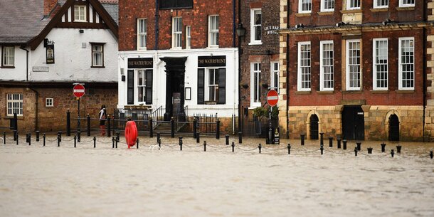
Hundreds of flights have been canceled in the UK this weekend due to a severe storm. A total of tens of thousands of passengers are affected at several airports, including those of the airlines Easyjet and British Airways. Meteorologists are again expecting flooding due to heavy rainfall, hundreds of houses could be affected.
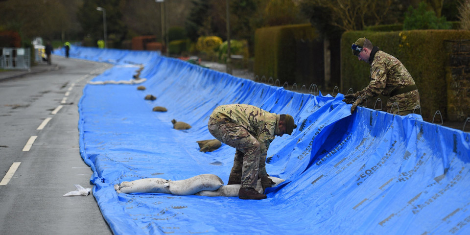
Storm “Dennis” is also likely to lead to disruptions in rail traffic, on the streets and in the power supply. Just a week ago, a severe storm had caused significant damage to the country. However, meteorologists rate storm “Dennis” as more dangerous than “Ciara”, which caused chaos last weekend. Because in some regions it could rain as much in one day or two days as in a whole month. Since the ground has softened in many places due to the last storm, the consequences are now likely to be more serious, according to the experts.
“Dennis” is heading for Austria
Soldiers are already helping the exhausted inhabitants of Calderdale in northern England, who are still suffering from the damage caused by the last storm. According to the meteorologists, “Dennis” will pick up speed over the course of Saturday and rage until about Sunday evening. The north and south-west of England and Wales are particularly affected.
And “Dennis” is also heading for mainland Europe. Austria will also feel its effects. First of all, however, it remains with us like spring.
Sunday
Over the lowlands, as well as in basin and valley areas, fog or high fog fields remain locally for the first half of the day. The sun shines off the fog at least temporarily, even if a few high and medium-high clouds pass by. The wind is weak to moderate, lively in the east, from east to southwest. Early temperatures between minus 5 and plus 4 degrees, afternoon temperatures between 6 and 17 degrees, the warmest it is in the west and at higher altitudes.
Monday
At first the sunshine dominates, over the lowlands there are regional fog fields during the first half of the day. From noon the clouds slowly become thicker from the west, until evening light rain sets in between Vorarlberg and the Waldviertel. The snowfall limit is between 1200 and 1700m. It remains longest sunny in the southeast between Lower Carinthia and Mittelburgenland. The wind is weak to moderate, mostly from the southeast to the west. Early temperatures minus 5 to plus 6 degrees, maximum temperatures 8 to 18 degrees.
Tuesday
Residual clouds of the nightly cold front are rapidly moving to the east, only in the south and southeast are the cloud fields more persistent. Everywhere else the sun often shines during the day, even if a few harmless cumulus clouds appear again in the north in the afternoon. In the north and east there is moderate to lively west to northwest wind, otherwise it is rather weak. Early temperatures minus 3 to plus 7 degrees, maximum daily temperatures 6 to 12 degrees.
– ,

