Pankratius, Servatius, Bonifatius and Sophie remain true to each other and ensure a cold snap.
–
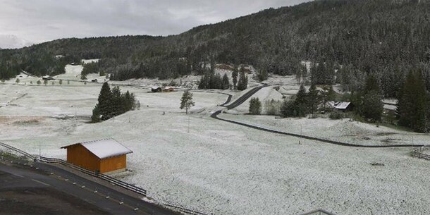
Pankratius, Servatius, Bonifatius and Sophie remain true to each other and ensure a violent onset of cold. In many parts of Austria there were snow flurries on Tuesday morning, even real snowflakes fell down to 500 meters. Some higher valleys (like Seefeld in the picture above) became white again in mid-May.

© Bergfex
Deep masses of snow on the Grossglockner High Alpine Road

© webcam
There was snowfall in many parts of Salzburg and Tyrol

© Bergfex
Light snowfall also on the Brenner
The forecast in detail
On Tuesday mornings rain showers often pull through, the snowfall limit is often between 500 and 1,000 meters on the alpine north side, much higher in the south. During the day, the sun will soon reappear, especially in the northern and eastern lowlands, and the last showers in the Northern Alps will soon fade away. However, it is likely to be more cloudy on the southern side of the Alps, where the tendency to rain increases again in the afternoon. It often blows only weak to moderate, but initially lively to strong winds from the northwest to the north of the Alps. The early temperatures are two to ten degrees, the maximum daily temperatures eight to 17 degrees.

–
The eastern Alps come into a western current on Wednesday, and a low forms on the ground above the Gulf of Genoa. So there is interference in Austria with widespread dense cloud cover and rain. Overall, it is slightly windy, in the east there is moderate wind from south to northeast. The early values are between two and eleven degrees, the highest values between ten and 18 degrees.
It’s getting milder again
The influence of interference only weakens gradually on Thursday. In many cases it remains strong, with cloudy clouds in the north and east. During the first half of the day it rains heavily except in the west. In the evening, the focus of precipitation is in the south and southwest. The snowfall limit on the north side of the Alps is again between 1,000 and 1,600 meters during the day. The wind from the northwest comes alive at the eastern edge of the Alps. The early values are between four and ten degrees, the daily highs between eight and 16 degrees.
With a southwestern current, another disturbance reaches western Austria on Friday, mostly with showers and occasional thunderstorms. In the east and southeast it remains rainless and still quite sunny. A lively southeast wind blows on the eastern edge of the Alps. Early temperatures reach three to eight 8 degrees, maximum daily temperatures 17 to 23 degrees.
– .

