Plans to transform northeast Mission Bay into a mix of marshes, campgrounds and recreation areas will take a key step Tuesday with the release of a multi-year city analysis of how changes might affect the environment.
The 446-page analysis, which concludes the proposal would have no significant adverse effects, allows the approval process to move forward until year-end hearings before the Planning Commission and City Council.
City officials also unveiled some revisions and refinements to the proposal Tuesday, including a third more land for active recreation areas, a third new beach and a clubhouse that would rent out non-motorized boats.
Additional land for active recreation, including ball fields or golf courses, comes at the expense of land for passive recreation, such as picnic areas, which would decrease by 43 percent.
Other changes include the creation of a possible second location for a planned wildlife interpretation center. The center could be on the south end of Mission Bay High School, next to the restored marshes, or near the shoreline of De Anza Cove.
Officials also consolidated their support Tuesday for prioritizing marsh restoration, which helps fight sea level rise and fuels the revival of habitats that were destroyed when the area was aggressively drained decades ago.
The latest proposal, which city officials call De Anza Natural, includes 219 acres of salt marsh and another 38 acres of dunes and environmental buffer zones.
This is a drastic change from the proposal approved in 2018 for the area by the Mission Bay Park Committee. That proposal included 120 acres of wetlands combined with more acres for camping and recreation, including a restaurant.
City officials began considering major changes to the northeast corner of Mission Bay seven years ago, when much of the area was made available for redevelopment following the closure of the De Anza Cove mobile home park.
Many see the latest proposal as a major victory for environmentalists in their long-running battle with golfers, campers and recreation advocates over this prime area.
But campers and golfers are not left out.
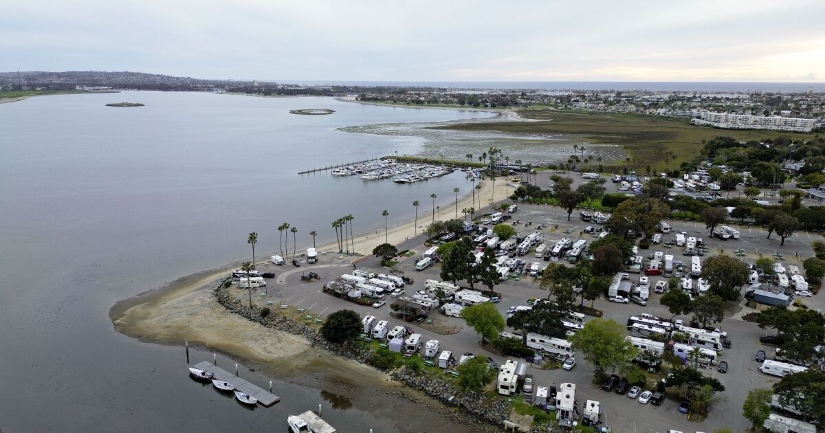
The entire site of Campland by the Bay, a privately run RV park, would be converted to mudflats. But new campsites would be created at De Anza Point. In the latest proposal there are 48.5 acres for camping.
Increasing the number of acres dedicated to active recreation from 45 to 61 could increase the prospects for the long-term survival of the 46-acre Mission Bay golf course, the only lighted one in the area.
Under the previous proposal, the golf course would have been the area’s only active recreational use if it survived. Now the course could survive and there would also be 15 acres for tennis courts, ball fields and other active recreational uses.
The additional 15 acres for active recreation are south of the golf course’s driving range, toward the bay. That area had been designated for passive recreation in the previous proposal, which was unveiled in January 2022.
“The De Anza Nature Plan proposes this significant increase in intended wetland, but also takes into account the need to balance all of these other uses on a relatively small piece of land,” said Heidi VonBlum, the city’s planning director.
The latest proposal does not specify the exact uses within the active recreation area. Vonblum said that will be decided by city parks staff in the next few years, when something called a “master development plan” is created for the area.
If the City approves a general plan for land uses in the area this year, city officials will then need to get final approval from the California Coastal Commission. After that, the staff could start creating the more specific development plan, Vonblum said.
Vonblum said the most recent revisions were largely due to public input during the creation of the city’s new analysis, called an environmental impact report.
A key change is adding a third beach to the plan. Two beaches had already been planned for the north and south sides of De Anza Inlet, which would be drastically revamped by cutting a water channel through De Anza Point.
The third proposed beach would be west of Interstate 5 and north of an existing pier near East Mission Bay Drive.
With the completion of the environmental impact review, City staff have also created a list of guiding policies for the new development in the northeast corner of Mission Bay.
These include increasing access to the area for Native Americans, low-income residents, and other people of color previously inaccessible, basing development decisions on building resilience to climate change, and diversifying recreational space to serve to more residents and more cultural groups.
Vonblum said the impacts analyzed in the EIR were relatively minor.
“I wouldn’t say there was anything flashy that would make us stop and reconsider what was ultimately proposed,” he said.
While the latest proposal has been praised by environmentalists, it doesn’t include as many acres of new marshland as a group called Rewild Mission Bay was calling for.
Of the 219 acres of marshland proposed by the city, only 140 acres would be new. The other 79 acres are the existing Kendall-Frost marsh north of Crown Point.
Rewild claims that 227 acres of new mudflats are needed to successfully combat sea level rise.

