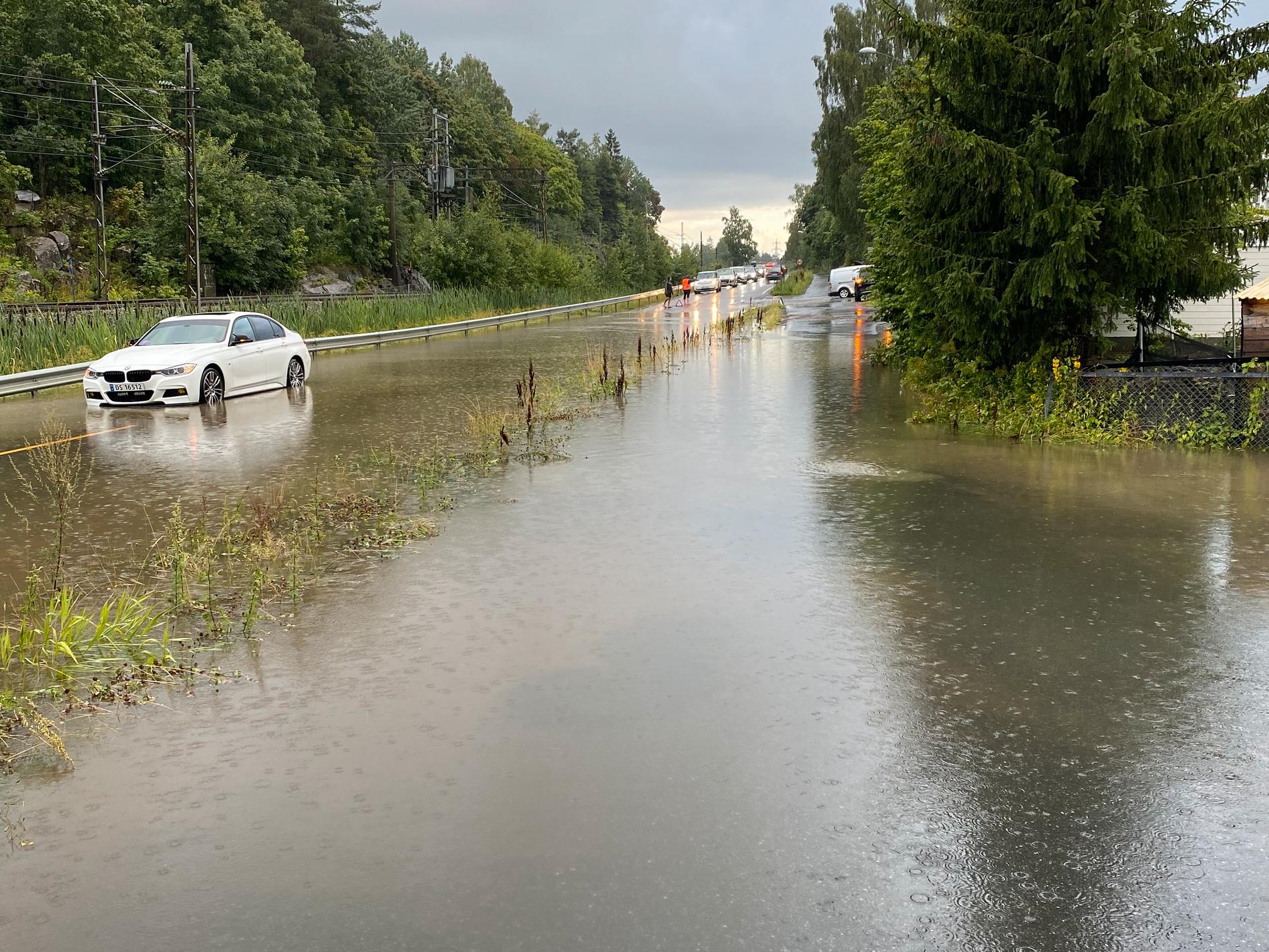
WATER: This is what a road in Nordre Follo municipality looked like on Saturday evening. Now even heavier rainfall is expected Photo: VG-tipser
On Monday and Tuesday, there will be an orange warning for precipitation over large parts of southern and eastern Norway. Meteorologist Isak Slettebø believes there could be 100 millimeters of rainfall per day in the most exposed areas.
Published:
Less than 20 minutes ago
A low pressure from south-eastern Europe is heading towards Norway. Martin Granerød, meteorologist at the Meteorological Institute says that large parts of the country must brace themselves for heavy rain.
– We have now forecast a lot of rain for parts of southern Norway, the easternmost part with Innlandet county, and from the south in Trøndelag down towards Oslo. This looks like it could be one of the most powerful events with a return value return value Statistical term. A return value of ten years means that there can be up to ten years between each time such a powerful event is expected. in ten years.
– It could be the heaviest rainfall in ten years?
– Yes, for the area, he replies.
The areas can expect both wind and thunderstorms, says Granerød. Nevertheless, it is the torrential rain that he believes will be the most inconvenient.
– Basically now it is the rainfall amounts that seem to be quite challenging in that area on Monday and Tuesday.
Info
These are the danger alerts
Yellow warning: Residents are asked to be aware. The situation is described as challenging. Most people will be able to continue with their daily activities.
Orange warning: Residents are asked to be prepared. The situation is described as serious. There will be a real danger that valuables and lives will be lost.
Red danger warning: Residents are asked to secure valuables. The situation is described as extreme. There will be a great danger that lives will be lost, and there could be great destruction to property and infrastructure.
Source: met.no
Show more Photo: Meteorological Institute
– Roads may be closed
– It is already starting to rain on the night of Monday, and then it will continue throughout Monday and Tuesday, with fairly heavy downpours eventually. Now 60-80 millimeters have been forecast within 24 hours. Some areas may seem to get even more than that.
Granerød explains that the low pressure on Saturday evening is still a long way off. At the moment it passes Hungary, the Czech Republic and Slovakia, he says.
– As it approaches, the forecasts will sharpen. The danger warning can be adjusted both ways, here and now we are at the orange level. We are in the assessment phase all the time here, so it is something we follow from hour to hour, in relation to what level we should be at.
If the predicted rainfall occurs, it could become quite challenging in the area, says Granerød. NVE has already sent out landslide and flood hazards, he says.
– After all, a lot of water tends to create several types of consequences. Difficult driving conditions due to the risk of aquaplaning. Roads may be closed due to streams and rivers overflowing their banks.
He encourages people to do an extra check and make sure the water has somewhere to drain away.
– Prepare for a lot of rainfall, especially in the easternmost part of southern Norway.
100 MILLIMETERS: Meteorologist Isak Slettebø believes in large amounts of precipitation on Monday and Tuesday. Photo: Private
Lowest ever
– I have not examined the statistics, but if you look at the air pressure in a low pressure, which gives a measure of the strength of the low pressure, then this could be the lowest ever recorded in the area. In At least 60 years.
That’s what StormGeo meteorologist Isak Slettebø says. He says there could be up to 100 millimeters of rainfall in a day in the most exposed places.
– Oslo’s biggest 24-hour rainfall is about 70 millimetres. I think this will get even worse and to a greater extent, for southern Norway and northern Eastern Norway in particular.
The reason for the large amounts of rainfall is, according to the meteorologist, complex.
– It’s August, so it’s sort of high season for tropical, so to speak, rainy weather. You also have very large temperature contrasts, so that the low pressure takes on a somewhat autumnal character. In a way, you have the worst of summer and the worst of autumn combined in a strong low pressure.
He believes that the Meteorological Institute is considering upgrading to danger level 3, red. The criteria for these danger alerts are regionally differentiated, he explains.
– If we look at the criteria, this is quite close to danger level 3 for the area.
– Haven’t seen the husband
Nevertheless, he emphasizes that it is the Norwegian Meteorological Institute that has the authority to publish danger warnings.
– People must follow the Meteorological Institute. They are the main authority here.
Slettebø says that it is not unusual for strong low pressure to come in from the Atlantic Ocean. However, this low pressure comes from the continent.
– When low pressure comes from the continent, they tend not to have as much spin. They are also not so big and powerful, and they pass quickly. This is different and therefore more serious.
He is aware that these are unusual weather conditions.
– I have not seen the husband. It’s the worst low pressure I’ve seen.
He recommends everyone in the exposed areas to check varsom.no to follow developments.
Published:
Published: 06.08.23 at 01:22
Copy linkCopy linkShare on FacebookShare on FacebookShare by emailShare by email
2023-08-05 23:23:21
#Orange #danger #warning #Havent #mate
