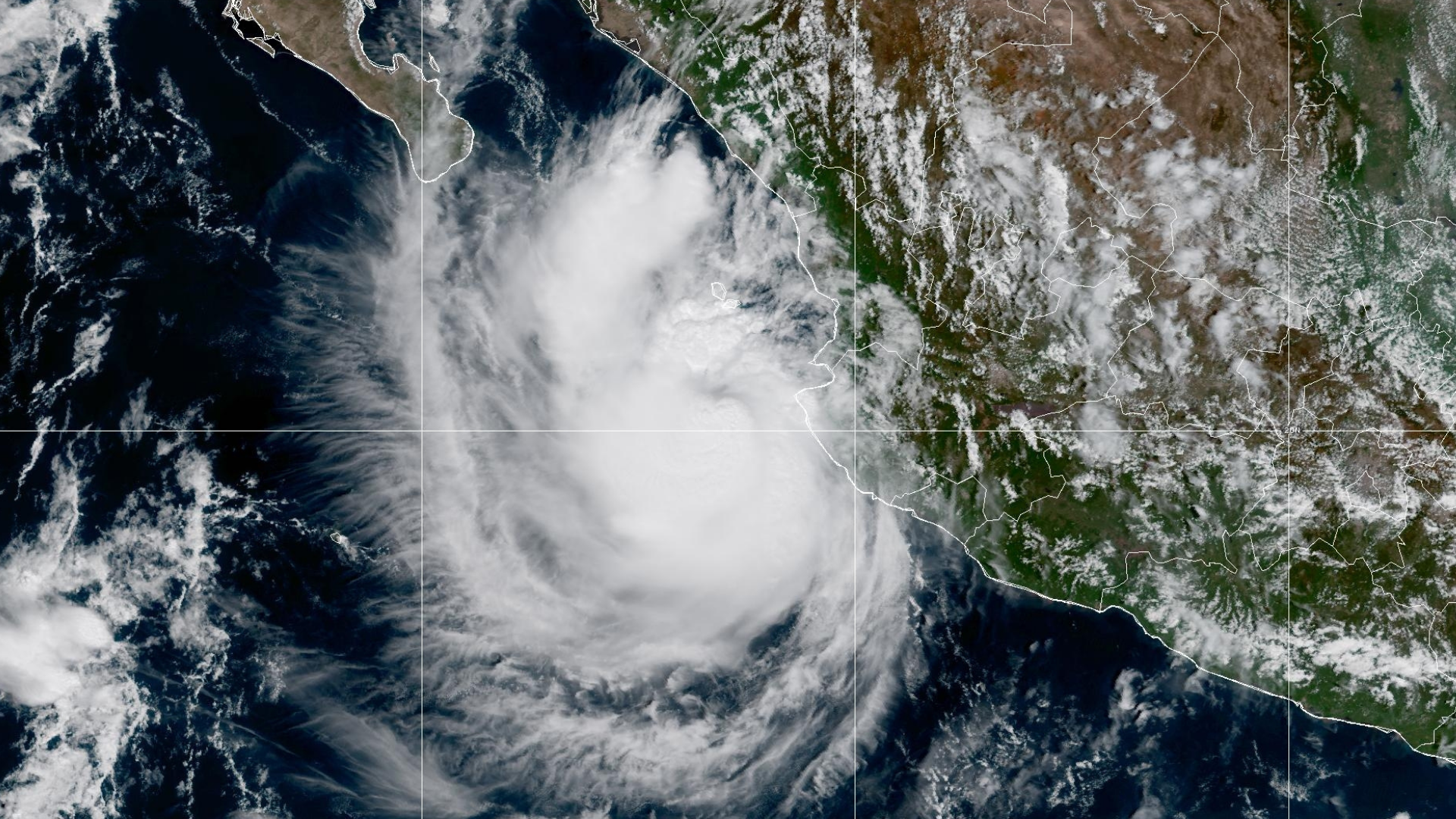
Hurricane Simon moisture could bring rain to west Texas, NHC and NWS say
Hurricane Simon is not expected to move into Texas, but its moisture could contribute to rain and potential flash flooding in West Texas and parts of the Southern High Plains this week, according to the National Hurricane Center and the National Weather Service.
Where is Hurricane Simon located now?
As of Monday morning, Oct. 12, 2026, Hurricane Simon was a Category 2 hurricane with maximum sustained winds of 110 miles per hour, located about 55 to 60 miles west-southwest of Cabo Corrientes and Puerto Vallarta, Mexico. The storm was moving northwest at a slow pace of approximately 3 miles per hour, staying just off Mexico’s Pacific coast.
When will Hurricane Simon make landfall in Mexico?
The storm is expected to remain a hurricane through midweek before moving inland and weakening.
How will Hurricane Simon affect West Texas and the Panhandle?
While the storm itself will not move into Texas, its remnant moisture is reaching north into the region. The Weather Prediction Center outlined a risk of excessive rainfall across parts of the Southern High Plains and Southwest Texas starting Wednesday, Oct. 14, 2026. This moisture will help fuel showers and thunderstorms across West Texas from the Big Bend up into the southern part of the Texas Panhandle through Thursday and Friday. Rainfall amounts are forecast generally between 1 and 2 inches, with isolated totals exceeding 3 inches, creating a primary weather threat of flash flooding due to repeated rounds of storms.
Why are Houston’s rain chances separate from Hurricane Simon?
While West Texas absorbs moisture from Simon, Houston and Southeast Texas are receiving rain chances tied to an entirely different system. As high pressure shifts east, that moisture is moving back into Southeast Texas to bring isolated to scattered showers and storms through midweek, mostly west of Interstate 45. These storms could briefly drop about an inch of rain, though widespread rainfall is not anticipated.
What weather conditions are expected after the midweek rain?
Drier air will move into Southeast Texas late Wednesday, Oct. 14, 2026, which will limit rain chances by Thursday. A separate cold front could reach the area by Friday, bringing cooler temperatures and drier air, with morning temperatures potentially dropping below 60 degrees over the weekend.