NWS Forecasts Heavy Rain and Coastal Risks for San Diego from Tropical Storm Rachel
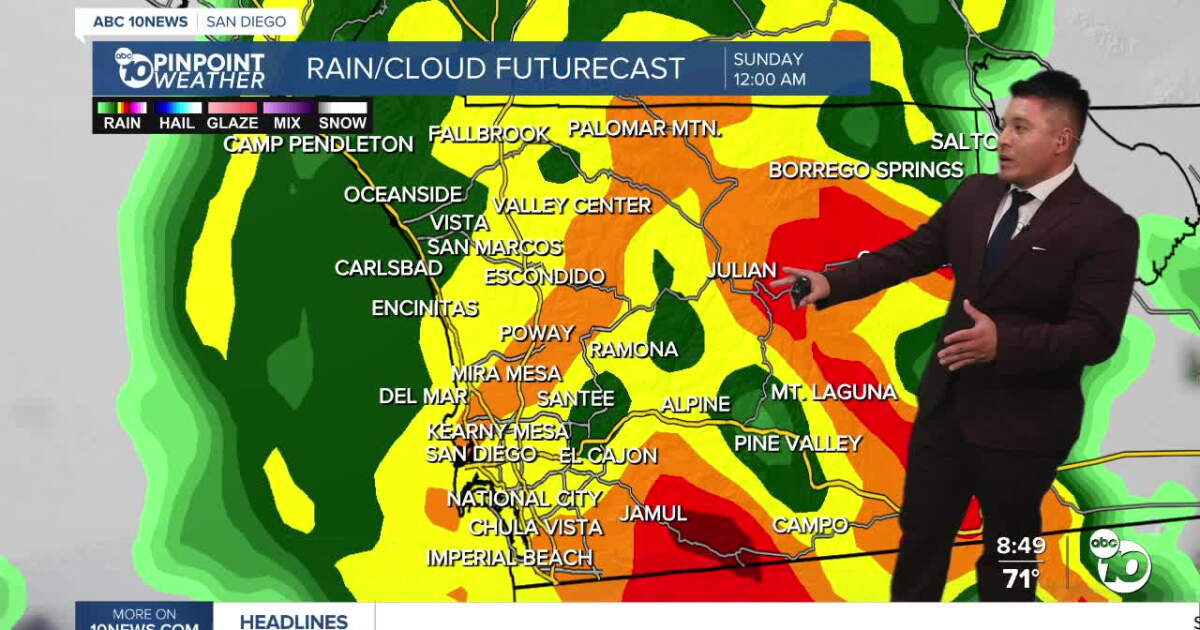
Tropical Storm Rachel is tracking toward Baja California, with the National Weather Service forecasting significant impacts across San Diego County beginning late Saturday, October 10, 2026. Residents should prepare for heavy rain, flash flooding, and strong winds, as the storm’s tropical moisture moves northward into Southern California through Sunday.
Heavy Rain Hits San Diego County Sunday Morning
While San Diego County will remain largely dry for most of Saturday, the primary band of precipitation is expected to arrive between 10 p.m. Saturday and midnight. Sunday. Widespread moderate to heavy rainfall is anticipated Sunday morning, with the intensity tapering off to scattered showers by late morning and early afternoon for coastal communities.
Rainfall totals remain subject to the specific track of the storm. The National Weather Service estimates a 60% probability that coastal and inland valleys will receive 0.75 to 1.5 inches of rain, while mountain areas could see 2 to 3 inches. If the storm tracks closer to the coast, those totals could climb as high as 2.5 inches in the valleys and 4 inches in the mountains. A Flood Watch is currently in effect for the county from Saturday evening through Sunday evening.
High Winds and Coastal Flood Warnings Peak Sunday
Beyond the rainfall, the storm brings a risk of high winds and dangerous surf. Coastal and inland valley communities may experience wind gusts ranging from 25 to 45 mph, while mountain ridges and desert slopes are projected to see gusts between 50 and 70 mph. These conditions, which are expected to peak Sunday morning, may disrupt travel for high-profile vehicles and cause localized damage to vegetation.
The coastline faces a distinct set of challenges. A Coastal Flood Warning is in effect through 3 p.m. Sunday due to the combination of tropical storm swells, high tides reaching 7.5 feet, and strong winds. Surf heights are expected to build to 5 to 8 feet, with occasional sets reaching 9 feet. Officials advise that beachgoers avoid the water and stay clear of unstable bluffs, jetties, and exposed rocks, as rip currents and coastal flooding pose significant risks.
Temperatures Drop as Additional Rain Follows Storm
The arrival of this tropical system will lead to a notable drop in temperatures. Highs across San Diego County are expected to fall 10 to 15 degrees by Sunday, with many areas reaching only the low 70s. The cooling trend continues into Monday, when temperatures in the coastal regions will stay in the 60s, and mountain elevations may dip into the 40s.
The weather remains unsettled into the new week. A separate upper-level system is forecast to bring additional, lighter rainfall to the region on Monday, with some light snow possible at elevations above 8,000 feet. Scattered showers may persist into Tuesday morning before conditions begin to clear. A warming trend is expected to develop during the second half of next week, with temperatures returning to seasonable levels by the weekend.
Flash Flooding Threatens Low-Water Crossings and Canyons
The forecasted flash flooding and high wind gusts present immediate challenges for local infrastructure, particularly in low-water crossings, canyons, and areas near creeks.
The uncertainty regarding the storm’s exact path remains the primary variable for forecasters. While the current models provide a high-probability scenario for rainfall and wind, the potential for higher totals remains if the storm shifts closer to the U.S.-Mexico border.