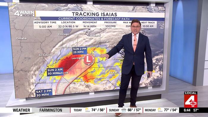
Hurricane Isaias Remnants to Bring Rain to Metro Detroit, clickondetroit.com reports
Metro Detroit will experience a mix of sunshine and clouds with temperatures reaching the mid-to-upper 70s before rain driven by the remnants of Hurricane Isaias moves into the region, clickondetroit.com reported.
Weekend Weather Transition From Sunshine to Rain
Saturday begins with sunshine before cloud cover increases during the afternoon and evening hours. High temperatures will climb into the mid and upper 70s by the afternoon. Conditions change Saturday night as skies turn mostly cloudy and rain showers become possible after midnight. Lows will drop to 58 degrees. Sunday brings mostly cloudy skies and continued chances of rain, which will hold afternoon highs down to the mid-60s. Sunday night remains dry with low temperatures settling at 56 degrees.
Hurricane Isaias Drives Rain System into Metro Detroit
The incoming moisture stems from Hurricane Isaias, which made landfall on Friday evening over the western Florida Panhandle as a strong Category 2 hurricane featuring winds near 110 mph. Forecasters are tracking the center of circulation as it drives the rain system northward into Metro Detroit. The precipitation will suppress daytime heating on Sunday, restricting high temperatures compared to the warmer start on Saturday.
Weather Outlook for Monday and Mid-Week
Monday stays dry for most of the day with a mix of sunshine and clouds, allowing high temperatures to rebound to the low and mid-70s. Another round of rain is expected to arrive Monday night and persist into Tuesday, pulling high temperatures back down into the mid-to-upper 60s. Drier weather returns on Wednesday before additional rain chances move back into the region for Thursday and Friday.