Above-Normal Temperatures Set to Return in Mid-October NOAA Outlook
NOAA’s Climate Prediction Center projects that above-normal temperatures will return to a large portion of the United States in the second half of October, breaking a recent chill, WeatherBug reported.
The upcoming warmth arrives after several days of noticeably cooler air across various regions. However, pattern shifts are pushing temperatures back upward as mid-October approaches.
The 8-to-14-Day Temperature Outlook
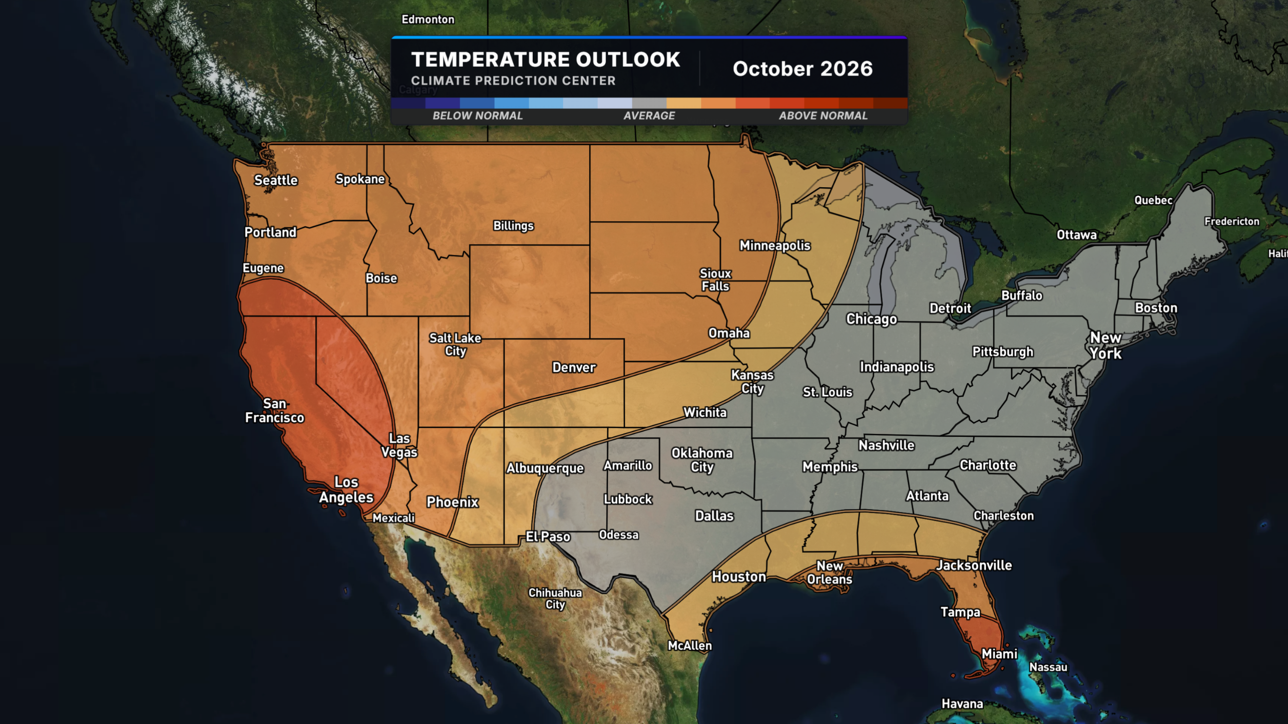
The temperature outlook covering October 9 through October 15 favors above-normal readings across much of the West, the northern and central Plains, the Upper Mississippi Valley, and areas near the Gulf Coast. The strongest signal for unusual warmth concentrates in California, western Nevada, southern Oregon, and much of Florida, where forecasters show the highest confidence in elevated temperatures.
Grey areas on the outlook map cover large portions of the Great Lakes, the Ohio Valley, the interior Northeast, and much of the South. These shaded zones do not indicate a forecast of stagnant conditions or an absence of weather. Instead, they reflect lower confidence from forecasters, meaning standard day-to-day weather swings will dictate local conditions rather than any broader seasonal lean.
Drivers Behind the October Warmth
This shifting weather pattern aligns directly with broader observations recorded throughout the season. A strengthening El Niño typically favors warmer and drier conditions across the Pacific Northwest and northern Plains. That established signal is already manifesting weeks ahead of the official start of winter.
Temperature volatility shows why localized conditions must be monitored regularly. Real-time updates help residents track shifting weather parameters across municipal boundaries.
Practical Impacts Across Regions
Outdoor plans in California, the Southwest, and the Florida peninsula will lean warm through the middle of October. Gardeners situated within these warm-leaning zones receive an extended window of mild weather before the season’s first freeze becomes an immediate concern.
Leaf peepers should anticipate changes to autumn foliage timelines. Sustained warmth slows the rate of color change across the Plains and parts of the West, meaning peak foliage in those specific warm-leaning areas may arrive later than in a typical year.
Uncertainty in Regional Forecasts
Recent cold air represents a short-lived drop rather than a permanent meteorological anomaly. Cold fronts continue to push across regions even during months that trend warmer on average.
The current outlook characterizes the broader atmospheric pattern over a concise one-to-two-week window. Because atmospheric conditions remain dynamic, forecasts require ongoing monitoring as October progresses rather than treating mid-month projections as a permanent baseline for the entire period.