
Unseasonably warm temperatures are gripping parts of Europe as a high-pressure system of African origin disrupts typical winter weather patterns, even bringing snowfall to subtropical regions. Whereas a cold snap had recently affected central Europe, with temperatures in the Po Valley dropping as low as -7°C, a significant shift is underway, according to meteorological reports.
The change is being driven by a large, expansive high-pressure area originating in Africa, which began to develop at the end of February. Experts at Ilmeteo.it predict a turning point on March 22nd, when the high-pressure system is expected to fully expand across central and western Europe, blocking any Atlantic disturbances or cold air incursions from the Arctic. This “maxi” high-pressure system, as it’s been termed, is notable for its vast reach.
The impact is already being felt. While the cold snap brought snow to low altitudes in central and southern Italy, that brief period of frigid weather is giving way to rising temperatures. Experts anticipate temperature anomalies of +10°C above the seasonal average across the Mediterranean basin. The current high-pressure system, although, appears more persistent than previous warm spells, promising a prolonged period of milder conditions.
This phenomenon is linked to what meteorologists are calling “Arctic Amplification,” a consequence of climate change that intensifies the exchange of air masses between the poles and the equator. This process contributes to both heat waves and cold snaps, while also increasing their duration. The current situation exemplifies a “blocking pattern,” where the high-pressure system has rapidly expanded, leading to unusually high temperatures, particularly in France, Spain and Germany, where temperatures have risen by over 15°C in a matter of days.
The situation in Italy has been somewhat tempered by the influence of the Mediterranean Sea, but the broader trend points to a season of “exclusive” high-pressure systems – those that initially appear temporary but become entrenched, dominating weather patterns for weeks. This mirrors a pattern observed in recent winters and summers, with high-pressure systems originating in North Africa becoming increasingly persistent.
The structure of these high-pressure systems contributes to the warming trend. High atmospheric pressure compresses the air column, leading to adiabatic heating. This is not simply a result of warm African air, but rather the physical effect of the pressure itself. This phenomenon, while not new, is occurring earlier in the year than typically observed.
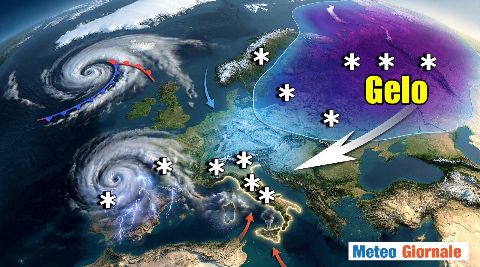
While the African high-pressure system shows some vulnerability in the Iberian Peninsula, where a low-pressure system is developing and bringing unsettled weather, there is also a potential for a shift in the northeast. The expansion of a high-pressure system from Russia and Siberia could impact the northern and eastern flanks of the current system, potentially lowering temperatures across central Europe and even Italy. However, the precise evolution of this Siberian influence remains uncertain.
Recent unusual weather events include snowfall at altitudes above 1,500 meters on the island of Madeira, a subtropical region, and on the peaks of the Canary Islands, specifically Tenerife’s Mount Teide. These events underscore the increasing unpredictability of weather patterns.
Meteorologists emphasize the high degree of uncertainty surrounding future developments. The key areas to watch are the evolution of the low-pressure system over the Iberian Peninsula, which is expected to intensify and bring unsettled weather to Sardinia and the Tyrrhenian Sea, and the progression of the Siberian high-pressure system. Further updates are expected as the situation evolves.