Typhoon Champi becomes super typhoon as Hong Kong expects heat
Typhoon Champi intensified rapidly over the Northwest Pacific, jumping from a strong tropical storm to a super typhoon within 24 hours as major meteorological agencies tracked divergent paths, reported on October 17, 2026.
Champi Strengthens Into a Super Typhoon
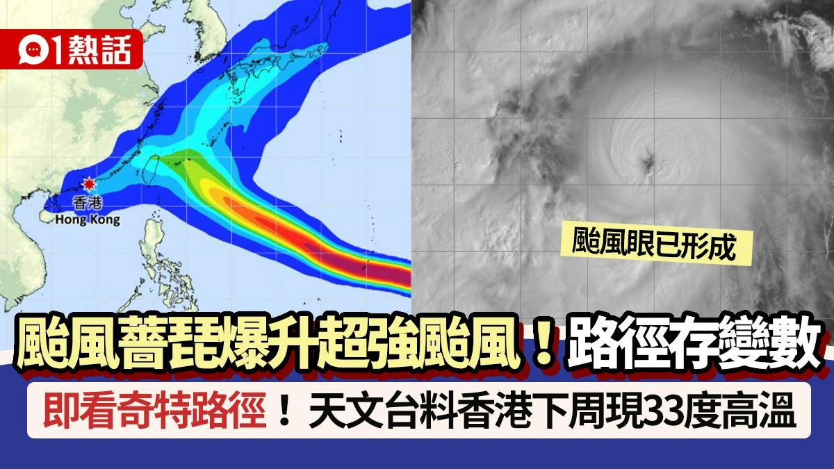
China’s National Meteorological Center reported that Champi packed maximum sustained winds of 52 meters per second, reaching scale 16 with a minimum central pressure of 935 hectopascals and a seven-grade wind circle radius spanning 350 kilometers. Real-time satellite imagery on Zoom Earth showed a clearly defined and tightly structured eye.
The system moved at 15 to 20 kilometers per hour toward the west-northwest, drawing closer to the sea east of Taiwan while continuing to intensify.
Divergent Paths Across International Models
Forecast models split into three distinct directions regarding Champi's future track.
Taiwan’s Central Weather Administration noted that Champi could develop into a major storm amid a super El Niño year. Meanwhile, the China Meteorological Administration identified October 21 and 22 as a critical window. If cold air fails to weaken the subtropical high-pressure ridge, the typhoon will likely maintain a westward track toward southern China, threatening Fujian and Guangdong.
Super El Niño Drives October Heat in Hong Kong
The Hong Kong Observatory explained that a super El Niño formed in September 2026, creating persistent anti-cyclonic circulation anomalies in the lower atmosphere from late September onward. This anomaly suppressed deep convection near the Philippines and South China while weakening incoming northeast monsoon winds, driving temperatures above normal during the first half of October.

With easterly winds easing and high pressure building, daytime temperatures will climb. The Observatory expects Wednesday, October 21, to turn intensely hot, with multiple New Territories districts reaching 35 degrees Celsius or higher, and Sheung Shui peaking at 37 degrees Celsius.
If the Observatory headquarters records a maximum temperature of 33 degrees Celsius or higher on October 21, it will break the record for the latest occurrence of hot weather in a calendar year, surpassing the previous record set on October 19, 2024.
Two Scenarios for Late-October Weather
An approaching westerly trough will weaken the subtropical ridge guiding Champi by mid-to-late week, though computer models differ on the exact depth of the trough and the extent of the ridge’s weakening. The Observatory outlined two primary scenarios depending on Champi’s position:
- Scenario One: A shallower westerly trough leaves the subtropical ridge strong enough to guide Champi westward toward China’s southeast coast, where it would eventually weaken under the influence of the northeast monsoon and bring showers to the region.
- Scenario Two: A deeper westerly trough weakens the ridge significantly, causing Champi to recurve northward toward the Ryukyu Islands and the East China Sea, leaving the coast of Guangdong with generally fine weather over the weekend.
The Observatory continues to monitor the development of the storm as forecasts remain subject to change.