NHC: 60% Chance Tropical Storm Kyle Forms off Southeast US Coast
A potential tropical or subtropical storm, named Kyle, is developing off the Southeast United States coast, raising storm risks for Florida and the Mid-Atlantic through the weekend.
National Hurricane Center tracking indicates increasing chances of development, with a 60 percent probability over seven days, leading to widespread coastal flooding and dangerous surf. Authorities warn that even without official naming, the system promises intense rainfall and gusty winds across the region.
The Southeast and Mid-Atlantic regions are currently bracing for severe weather as a non-tropical low-pressure system forms east of the Florida peninsula. This system, which is associated with disorganized showers and thunderstorms extending over the Bahamas and Florida, could bring strong winds, dangerous surf and coastal flooding along portions of the Southeast and Mid-Atlantic coasts.
The risk is compounded by persistent easterly winds, which have funneled substantial moisture into Florida, fueling the ongoing heavy rain.
The Probability of Subtropical Storm Kyle’s Development
The formation of Tropical Storm Kyle, or a similar subtropical system, is an evolving forecast that demands constant monitoring.
Fox Weather reports that the odds of development stand at a low 30 percent chance over the next 48 hours, but that probability rises substantially to a medium 60 percent chance over the next seven days. This shift suggests a growing area of concern for coastal communities from Jacksonville to South Carolina.
The National Hurricane Center notes that a subtropical storm typically features a large, cloud-free center of circulation with intense thunderstorm activity located at least 100 miles away from the core. “The difference between a subtropical storm and a tropical storm is not that important as far as the winds they can generate, but tropical storms generate more rain,” according to the National Weather Service.

An AccuWeather meteorologist, Gwendolyn Fieweger, advised via email on November 19 that the developing low-pressure area offshore could bring “additional heavy rain, flooding and gusty winds to Florida, particularly along the Atlantic coast,” depending on how close the storm tracks to land.
Intense Rainfall Band Threatens Florida Peninsula
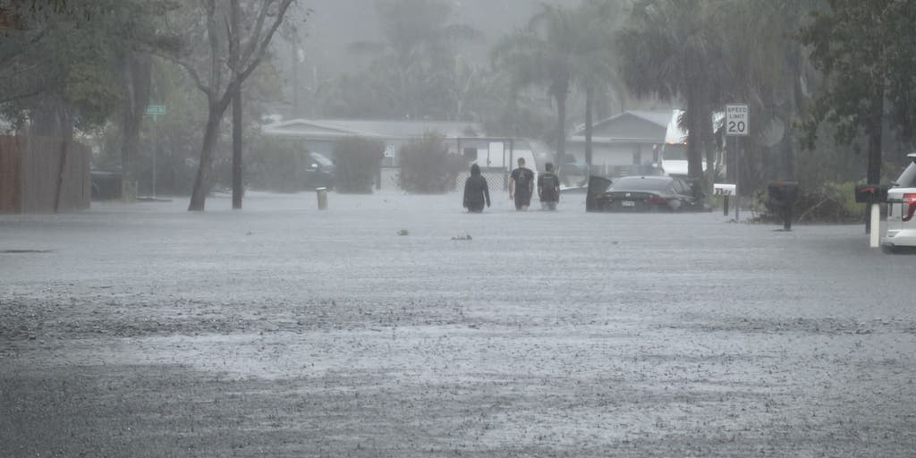
Even without an official name, the region faces immediate danger from strong winds, dangerous surf, and coastal flooding. The Florida Peninsula is already experiencing “extremely wet conditions” fueled by the low-pressure system spinning up near the Bahamas.
Meteorologist Matt Lanza, speaking on The Eyewall, said that a narrow but intense band of rainfall is expected over the Florida Peninsula, specifically south and east of Orlando as the low pressure moves north on Friday.
The forecast for the space coast indicates a high potential for torrential downpours. Lanza predicted that areas between St. Augustine and West Palm Beach, along with Melbourne and Palm Bay, could see 5 inches or more of rain within a 24-hour period ending at 7 a.m. on Friday.
The Weather Prediction Center (WPC) has issued alerts regarding these immediate threats. The WPC places the Space Coast area at a moderate risk—level 3 of 4—for excessive rain and flash flooding on Thursday.
By Friday, additional heavy rain is anticipated, with forecasts suggesting 4 to 8 inches of rain along Florida’s east coast, with localized pockets of 8 to 12 inches possible. Lanza cautioned that these rains could be slow-moving and particularly torrential in spots.
Mid-Atlantic and Southeast Coastal Warnings
The threat goes well beyond Florida’s borders. FOX Weather reports that a non-tropical low-pressure system is expected to move northward and northeastward near the southeastern U.S. coast through the weekend, targeting the Mid-Atlantic and Southeast regions.
This increased moisture is poised to bring widespread rain from Jacksonville, Florida, all the way to Savannah, Georgia, and Myrtle Beach, South Carolina. FOX Weather forecasts that by Saturday afternoon and into the following night, heavy rain will primarily affect Georgia and the Carolinas.
A Level 2 out of 4 flash flood threat is currently in place from northeastern Florida into coastal South Carolina on Saturday, according to FOX Weather.
“It’s now expected that sometime Sunday, the center of our coastal low will push closer to the Outer Banks, likely skimming the coastline.” – FOX Forecast Center
This shift in the storm’s potential track, which could push toward the Outer Banks on Sunday, increases the risk of flash flooding farther north across the Carolinas.
The potential for severe coastal flooding and dangerous surf necessitates immediate preparation from both residents and local governing bodies.
The threat to coastal property is real, particularly as wind gusts could range from 40 mph or higher, increasing ocean intensity and the risk of coastal erosion.
The Atlantic Hurricane Season Context and Future Monitoring
Hurricane hunters are scheduled to begin flying into the area on Friday afternoon to observe the system’s progression. Tracking the system’s movement and intensity will determine if it develops into a subtropical depression or a full tropical storm.
The National Hurricane Center, the National Weather Service division responsible for issuing the advisories guiding this forecast, traces its origins to hurricane warning services first set up in Cuba in the 1870s by Father Benito Viñes, with United States responsibility shifting to Washington, D.C., in 1902.
The office moved to Miami in 1943, and storm naming began for Atlantic tropical cyclones by 1947, with human names adopted in the 1953 season. Officially referred to as the NHC in 1965, it is now based on the campus of Florida International University in Miami and serves as the World Meteorological Organization’s designated center for tropical cyclone forecasts across the North Atlantic and eastern Pacific.
Ultimately, the severity of the impacts on Florida will depend on the projected track and proximity to land. As the system moves north, continuous monitoring of official National Hurricane Center advisories remains the primary source of actionable information for residents across the affected coast.