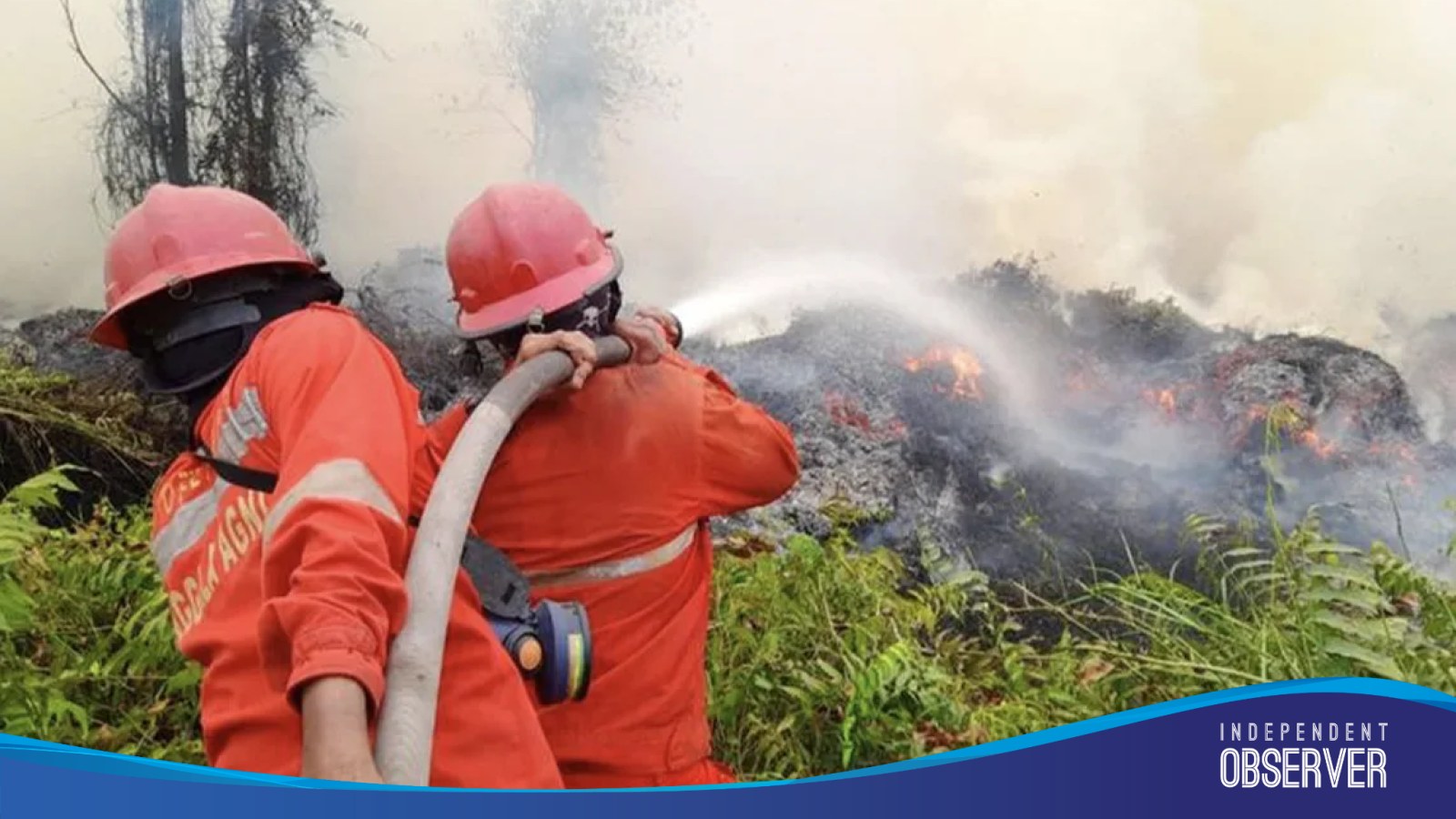
Indonesia Forest Fires Hit Third-Highest Emissions on Record in 2026
“This year’s forest fires are extremely severe,” said Laurensius Mikan, a 30-year-old resident of Subur village in South Papua, who has spent the past two months standing night watch as flames close in on his community.
Indonesia’s forest and land fires had generated nearly 200 million metric tonnes of carbon emissions in 2026 as of November 15, according to the European Union’s Copernicus Atmosphere Monitoring Service, as reported by Reuters. That makes this the third-highest annual figure since the monitoring service began tracking fire emissions in 2003.
The scale is difficult to overstate in national terms. The 2026 fire emissions amount to more than one-fifth of Indonesia’s total carbon footprint for 2025, when the country’s energy consumption and industrial sectors produced around 960 million tonnes of carbon dioxide, according to the Statistical Review of World Energy.
By another comparison drawn from the same figures, the fires this year emitted almost as much as Pakistan’s combined energy and industrial sectors did in 2025.
Indonesia has experienced its worst fire season in several years.
Millions of hectares estimated burned
Copernicus estimates that nearly 8.9 million hectares of land could be affected by fire across Indonesia throughout 2026 — roughly 4.7 percent of the country’s total land area. That is far above the 1.9 percent average for the years 2012 to 2025.
A different monitoring platform puts the burned area lower. The Nusantara Atlas geospatial service estimated that around 2.9 million hectares had burned between January and October, a figure it released the week before the Copernicus data emerged. The gap reflects the methodologies used.
| Measure | 2026 figure | Comparison |
|---|---|---|
| Carbon emissions | Nearly 200 million tonnes | Third-highest since 2003 |
| Land affected (Copernicus estimate) | 8.9 million hectares (4.7% of land area) | 2012–2025 average: 1.9% |
| Land burned (Nusantara Atlas) | 2.9 million hectares | January–October |
Fires reach Papua’s sago heartland
Reporting from Boven Digoel Regency in South Papua, Tempo described villages where the fires have come closer than residents can remember. Laurensius Mikan told Tempo that the fires of 2015 never approached Subur village; this year, flames have consumed every tree in their path, including sago palms growing just one kilometer away.
Villagers have tried a number of ways to keep the flames from reaching their homes, including digging firebreaks, clearing dry branches and trees from the land, and patrolling around the village.
In Kinggokambenap village, resident Petrus Kinggo could only watch as dozens of his sago trees were blackened by the flames after a fire began along the Trans-Papua Highway before spreading toward the settlement. In his view, this year’s forest fires are the worst in the past two decades.
The destroyed sago palms carry a food-security risk beyond the immediate damage: Tempo reported at the end of 2025 that women in Subur process sago into flour, which is sold and also serves as a staple food.
Indonesian Forestry Minister Raja Juli Antoni said social forestry areas have recorded relatively few forest fires.
Health report documents 174,694 respiratory infections
The health consequences are already counted.
An interfaith climate secretariat formed in Jakarta on July 27, 2026 — initiated by Yayasan Amanah Daya Nusantara (AYANA), with representatives of six religious communities signing a memorandum of understanding and a charter — has called for an end to the yearly fire cycle.
“Every hotspot that appears is a sign that prevention has already failed.” “The real achievement is when there’s nothing left to put out,” Rizal said.
Peatland drainage keeps the risk high
Plantation forest concessions is one of the main concerns.
The Copernicus Atmosphere Monitoring Service, which produced the emissions figures, is implemented by the European Centre for Medium-Range Weather Forecasts and was launched on November 11, 2014. It is one of six services under Copernicus, the European Union’s earth observation programme managed and coordinated by the European Commission, the European Space Agency, EU Member States and some EU agencies.
The service provides continuous data and information on atmospheric composition, describing the current situation, forecasting conditions a few days ahead and analysing retrospective records for recent years. It tracks air pollution, solar energy, greenhouse gases and climate forcing globally, building on roughly 10 years of development before its launch.
For now, the Copernicus figures run only through November 15, and the service’s estimate of affected land covers the whole of 2026.