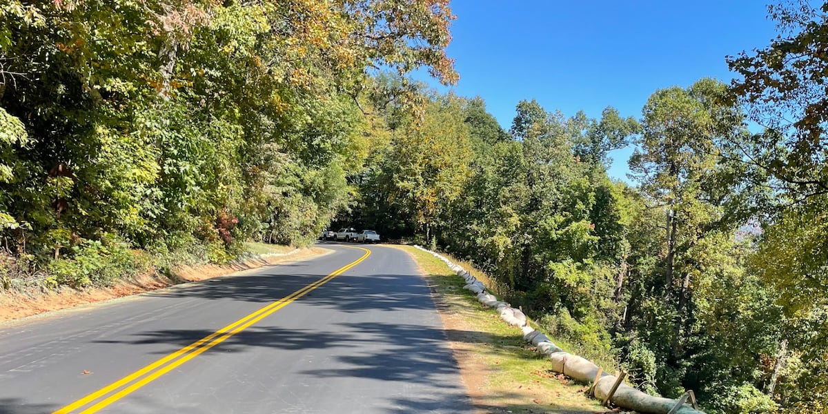
Final Helene-Damaged Stretch of Blue Ridge Parkway Reopens Ahead of Thanksgiving
The final 11-mile segment of the Blue Ridge Parkway severed by Hurricane Helene reopened to traffic Saturday, restoring continuous motor access across the last storm-damaged corridor ahead of the Thanksgiving holiday.
The National Park Service announced Saturday, Nov. 21, 2026, that the stretch from Milepost 344 at NC-80 to Milepost 355 near Mount Mitchell State Park is open, FOX Carolina reported.
Hurricane Helene struck Western North Carolina in September 2024, bringing heavy rainfall, flooding, landslides and debris flows that damaged the Blue Ridge Parkway. The storm triggered more than 60 distinct landslide events along the parkway, including 12 major slide sites within this final 11-mile section, according to NPS tallies cited by WNC News.
Superintendent Tracy Swartout called the reopening a reflection of dedication from employees, contractors, partner agencies and local communities who worked throughout the recovery. “We are grateful for their continued support and look forward to welcoming visitors back to these areas in time for the Thanksgiving holiday,” Swartout said in a release.

Motor vehicle access is restored, but the construction footprint remains live. Crews continue stabilizing slopes, repairing drainage structures and replacing guardrails across the corridor. The Park Service advises drivers to expect sporadic, short-duration single-lane closures and brief delays between Milepost 317 and Milepost 355, WNC News reported. Flaggers and heavy equipment operate adjacent to travel lanes; speed reductions and extra travel time are necessary.
While the NC-80 to Mount Mitchell segment opened Saturday afternoon, neighboring high-elevation sections immediately to the south remained closed due to weather, per official NPS road status updates cited by WNC News. Mount Mitchell State Park at Milepost 355.3 was closed, as was the parkway from NC-128 to south of the Craggy Gardens Tunnel, including the Craggy Gardens Visitor Center from Mileposts 355.3 to 364.5.

The parkway does not apply road salt or chemical de-icers. Gates along high-elevation stretches close rapidly when freezing fog, black ice or snow develop, even while lower valleys remain dry. Travelers planning a continuous north-south transit should verify real-time status via the NPS park conditions page before departure.
| Metric | Figure | Scope |
|---|---|---|
| Total landslide sites restored | 60+ | Full parkway corridor |
| Major slides in final 11-mile stretch | 12 | Milepost 344–355 |
The Park Service encourages visitors to plan ahead before traveling the parkway. Seasonal weather, maintenance activities and other conditions may result in temporary road or facility closures. Higher elevations experience rapidly changing weather, and winter conditions may affect travel even when lower-elevation areas remain clear, FOX Carolina reported.
The Blue Ridge Parkway stretches 469 miles through 29 counties in Virginia and North Carolina, linking Shenandoah National Park to Great Smoky Mountains National Park. It has been the most visited unit of the National Park System nearly every year since 1946. The road reaches its highest elevation of 6,053 feet at Richland Balsam near milepost 431, and its design as a scenic byway includes 26 tunnels and 168 bridges.
Because the parkway does not use road salt or chemical de-icers, high-elevation sections often close from late fall through early spring when freezing fog, black ice, or snow develop.
Drivers should monitor the NPS Blue Ridge Parkway road closure map for real-time gate status and construction advisories.
“Hurricane Helene presented extraordinary challenges for the Blue Ridge Parkway and the surrounding region.”
Tracy Swartout, Blue Ridge Parkway Superintendent