
## Remnants of Typhoon Halong to Fuel Potent Storm System in California and Beyond
The remnants of Typhoon Halong are forecast to significantly impact weather patterns across the Western United states, potentially bringing hurricane-force winds to Alaska’s Bering Sea this weekend and a major storm system to California early next week. This phenomenon is driven by what are known as “recurving typhoons.”
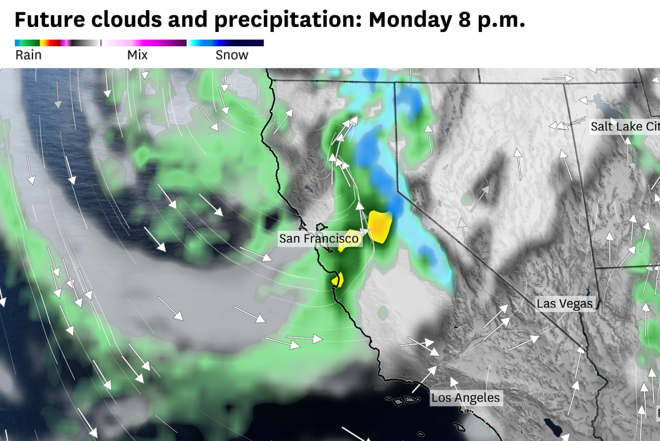
the amplified jet stream is expected to push a large high-pressure system into Canada, displacing subarctic air southward towards Washington state, Oregon, and California starting Monday. This interaction could result in heavy rainfall in the Bay Area and substantial snowfall – potentially feet – in the Sierra Nevada mountains from Monday through Wednesday.
While the exact timing and location of the most intense impacts remain uncertain, depending on the storm’s track, the Bay Area could experience its largest rainstorm since last winter. If the storm moves closer to the coast, heavier rainfall is anticipated; a more eastward track could lead to increased snowfall in Lake Tahoe.
This isn’t an isolated event.Remnants of West Pacific typhoons have demonstrably influenced West Coast weather multiple times in the past decade. A significant wildfire outbreak from Washington state to California in September 2020 was linked to powerful, dry winds caused by a recurving typhoon. Similarly,a rare August storm last year brought snow to the Sierra Nevada, also attributed to a recurving typhoon.
Beyond California, former Hurricane Priscilla is predicted to make landfall as a tropical depression in Baja California this weekend.While its hurricane-force winds are not expected to extend into the U.S., the storm’s moisture will likely bring increased risk of flooding to the Desert Southwest from Thursday through saturday. The National Weather Service has warned of potential rainfall totals of up to 4 inches in the mountains of Arizona, and up to 2 inches in Phoenix.Flood risks also extend towards Palm Springs and Las Vegas, with the possibility of strong thunderstorms Thursday and Friday. Though downpours are expected to remain primarily east of San Diego and Los Angeles, thunderstorms are still possible, notably on Thursday.
In the immediate term, Bay Area residents can anticipate drizzle on Thursday due to a deep marine layer, resulting in cloudy, damp, and cool conditions.A chance of rain exists in the North Bay on Friday and Saturday, though a low-pressure system remains offshore. More widespread showers are expected from Ukiah to Eureka and around Mount Shasta. Sunday is forecast to be drier, with clearing skies potentially offering a brief period of tranquil weather coinciding with Fleet Week festivities in San Francisco.