
Open up the government’s national weather-alert map, and pretty much the entire eastern half of the country is painted one color or another.A thick pink band stretches from New Mexico, across Texas, then through Pennsylvania, new York, and Vermont—a winter-storm warning. To the north, a dark-blue splotch around the Great Lakes—extreme-cold warning.And then a narrower, deep-purple band through the Southeast, from East Texas up through the Carolinas—ice-storm warning.
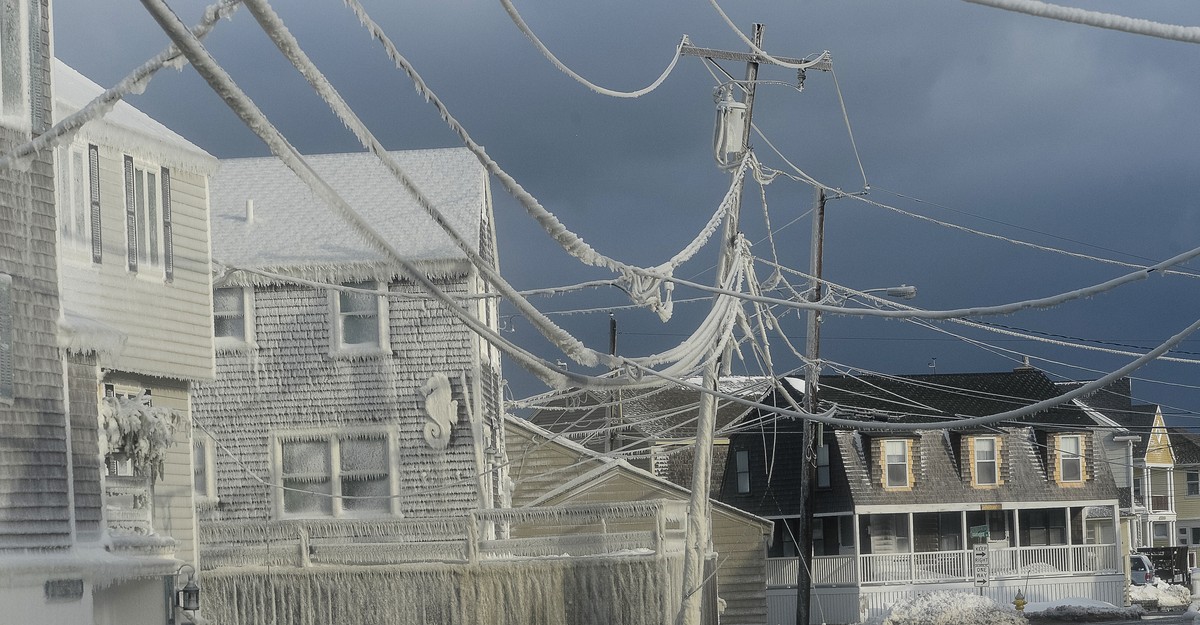
By Sunday, when the storm peaks, more then half of the people in the lower 48 will be experiencing some combination of snow, sleet, and freezing rain. Sixteen states and Washington, D.C., have declared states of emergency.Colder-than-usual air from Canada will drift across the eastern United States and meet up with an atmospheric river from the pacific. the U.S. “didn’t have any hurricanes last year, but this is definitely the equivalent of a hurricane, from Texas to the Northeast,” in terms of its potential for power outages and wind damage, Ryan Maue, a meteorologist and the former chief scientist at the National Oceanic and Atmospheric Management, told me. Those in the band with an ice-storm warning, he said, should think of “preparing for a hurricane—except it’s ice.” Many of these regions aren’t used to getting this kind of winter weather.And as one man in North Carolina posted on X, “Ice will humble you fast.”
“Two or three inches of snow, we can handle that,” Maribel Martinez-Mejia, the director of emergency preparedness for the North Central Texas Council of Governments, told me.But, she said, more than a quarter inch of ice is a challenge; her region could see about half an inch or more. That amount can add as much as 500 pounds of weight to a power line and cause an outage. “The power grid is vulnerable to ice,” Jason Shafer,