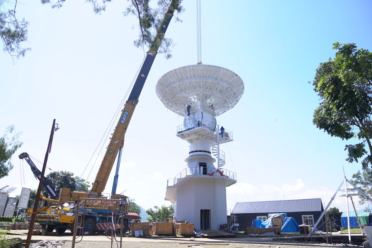
VGOS Bosscha Observatory ITB Expands Indonesia’s Role in Global Astronomy and Geodesy Research
The Institut Teknologi Bandung (ITB) has launched the Virtual Geospatial Observatory System (VGOS), a strategic initiative designed to integrate Bosscha Observatory’s capabilities into the global network of Very Long Baseline Interferometry (VLBI). The system aims to elevate Indonesia’s contribution to international astronomy and geodesy by providing high-precision data for the measurement of the Earth’s crust and the observation of celestial bodies.
Technical Integration and Global Geodesy
The VGOS project leverages the principles of interferometry, combining signals from multiple radio telescopes across the globe to create a virtual telescope with a diameter equivalent to the distance between the stations. By participating in this network, Bosscha Observatory allows Indonesia to contribute to the International VLBI Service for Geodesy and Astrometry (IVS), which monitors tectonic plate movements and the precise orientation of the Earth’s axis.
This capability is critical for the refinement of the International Terrestrial Reference Frame (ITRF). The ITRF serves as the foundational coordinate system for Global Navigation Satellite Systems (GNSS), including GPS. Precise measurements from the VGOS network reduce errors in calculating the positions of tectonic plates, which is a primary requirement for monitoring seismic activity and sea-level rise in the equatorial region.
Institutional Objectives at Bosscha Observatory
The implementation of VGOS at Bosscha Observatory marks a transition toward more digitized and automated observation processes. According to ITB, the system is intended to bridge the gap between traditional optical astronomy and modern radio astronomy. By expanding its role in geodesy, the observatory is moving beyond purely academic research into the realm of critical geospatial infrastructure.

The initiative is structured to facilitate collaboration between Indonesian researchers and international astronomical bodies. This includes the synchronization of data streams with other VGOS stations worldwide, ensuring that the data collected in Indonesia meets the rigorous calibration and timing standards required for global geodetic products.
Strategic Impact on Regional Research
Indonesia’s geographic position on the equator provides a unique vantage point for observing both the northern and southern celestial hemispheres, as well as monitoring the convergence of several major tectonic plates. The VGOS system utilizes this positioning to improve the accuracy of the global VLBI network, which historically has had a higher density of stations in the northern hemisphere.
The system’s operational capacity allows for the observation of quasars—extremely distant and bright galactic nuclei—which serve as fixed reference points in space. By measuring the angle between these quasars from different stations on Earth, researchers can determine the distance between those stations with millimeter-level precision.
The next phase of the project involves the continued calibration of the VGOS equipment to ensure seamless integration with the existing global array of radio telescopes.