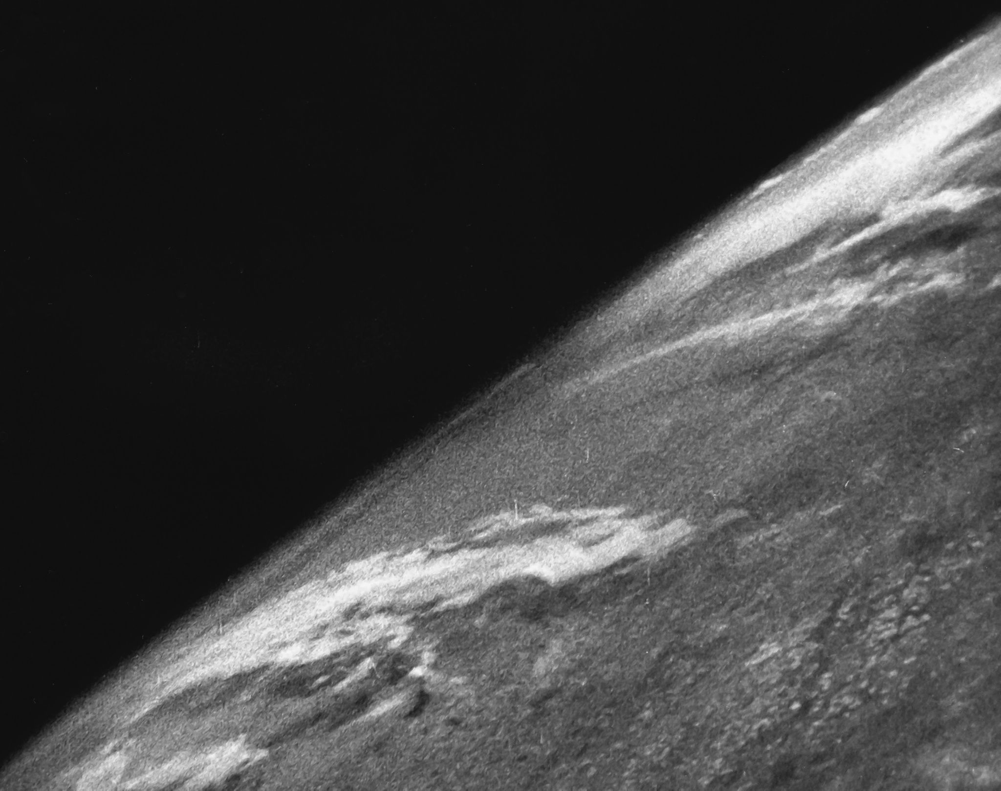
V-2 Rocket Captures First Ever Photo of Earth from Space in 1946
White Sands V-2 Launch Secured First Space Images of Earth
On October 24, 1946, a V-2 rocket launched from the White Sands Missile Range in New Mexico, carrying a 35-millimeter motion picture camera that captured the first-ever photographs of Earth from space.
The Tech TL;DR:
- A U.S. Army V-2 rocket reached an altitude of roughly 65 miles during the October 24, 1946 test flight at White Sands Missile Range.
- The onboard 35mm motion picture camera shot one frame every second and a half before the hardware impacted Earth at approximately 340 miles per hour.
- While the rocket and camera were destroyed upon impact, the film survived inside a protective steel case retrieved from the New Mexico desert by scientists.
Steel Case Protects Film During V-2 Rocket Crash
The mission utilized V-2 rockets in New Mexico. A mechanical motion picture camera was housed inside a protective steel case. As the vehicle reached an altitude of about 65 miles, the camera continuously exposed black-and-white film frames against the curvature of the planet.
The rocket fell back toward the surface, striking the desert floor at a velocity of about 340 miles per hour. The rocket and camera were destroyed, but the internal steel case maintained its structural integrity. Researchers driving out into the New Mexico impact zone extracted the intact film rolls, revealing grainy perspectives of the terrestrial horizon that had never been documented before.
Space Photography Enables Military Reconnaissance and Environmental Awareness
The ability to photograph Earth from space unlocked military reconnaissance capabilities on a scale far surpassing high-altitude aircraft. Those same imaging principles expanded into agricultural and meteorological purposes, eventually making Earth observation one of the most common reasons satellites and space stations are deployed into orbit today.
The resulting visual data fundamentally shifted public perception. Seeing the planet framed as a “blue marble” suspended against an endless black void provided early impetus for the environmental movement, illustrating the fragility of the orb.