
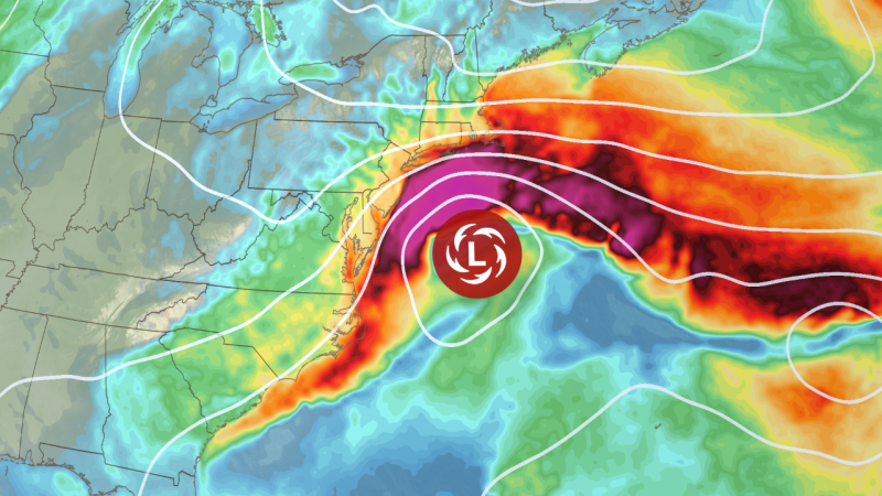
A powerful nor’easter is poised to batter the East Coast this weekend, bringing the threat of fierce winds, major coastal flooding, and heavy rainfall from the Outer Banks to the Northeast. The storm could cause power outages and render some roads impassable, with water levels potentially reaching heights not seen since Superstorm Sandy in 2012.
The combination of strong winds pushing water onshore and soaking rain will elevate tide levels to near their monthly peaks. Dozens of coastal locations from North Carolina to New York are forecast to experience moderate-to-major flood stage. In Delaware and New jersey, notably the southern regions, the National Weather Service warns that flooding could become severe enough to inundate roads and structures.
Water levels in Atlantic City, New Jersey, are predicted to surpass 8 feet on Sunday afternoon-the highest level since Superstorm Sandy-potentially triggering widespread road closures and isolating neighborhoods, according to NOAA data. Turbulent seas and dangerous surf conditions are also expected along hundreds of miles of coastline.
While the storm is expected to move away by Monday and Tuesday, offering a brief respite, another wave of unseasonably warm weather is forecast to arrive by late next week.