
Roman Road Trip: New Digital Map Reveals Ancient Travel Times from Netherlands & Belgium to Spain
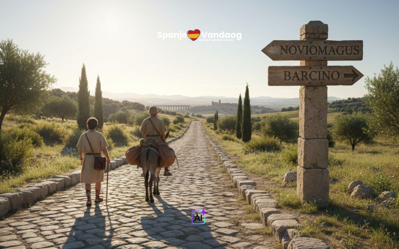
AMSTERDAM - A newly unveiled digital map detailing nearly 300,000 kilometers of Roman roads is offering unprecedented insight into the realities of travel within the vast Roman Empire. The project, developed by an international team of scientists, reveals how long it took to journey from Roman-era settlements in the Netherlands and Belgium to cities across Roman Spain – a trip that could take weeks, even with the aid of a donkey.
The map accounts for natural obstacles and varying modes of transport, demonstrating the logistical complexities of the era. According to data from the project, a traveler departing from Noviomagus (modern-day Nijmegen, Netherlands) could expect a 363-hour journey on foot, or 323 hours riding a donkey, to reach Barcino (Barcelona, Spain). Trips to Valentia (Valencia) required 451 hours on foot or 401 hours by donkey.
From Atuatuca (Tongeren, Belgium), the journey to Barcino was estimated at 326 hours on foot or 290 hours with an ass, while reaching tarraco (Tarragona) took 349 hours walking or 310 hours riding. Travelers heading to Valentia from Atuatuca faced 414 hours on foot or 368 hours with a donkey, and the longest route, to Malaca (Malaga), demanded 562 hours walking or 500 hours riding.
Researchers hope the freely accessible digital map – available at https://itiner-e.org/ - will appeal to both academics and the public, offering a tangible understanding of Roman logistics and potentially informing modern infrastructure planning. The project is expected to receive further updates with more detailed information on cities, trade routes, and shipping connections.