Long Island faces Friday storms before colder weekend temperatures
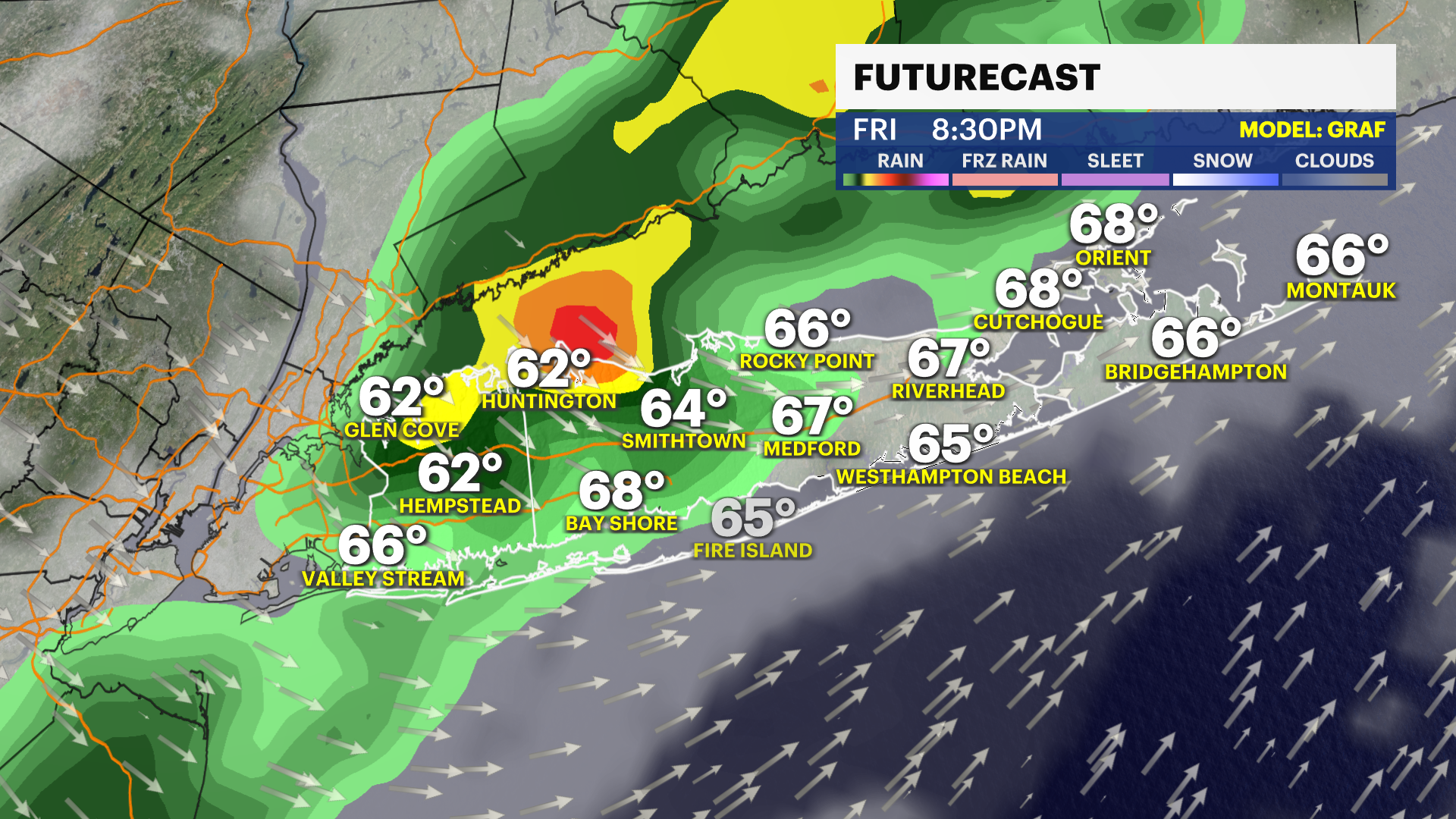
Long Island residents face scattered morning rain showers and a potential evening severe thunderstorm with wind gusts reaching up to 60 mph on Friday, before transitioning into a significantly colder weekend with morning wind chills dropping into the 30s, longisland.news12.com reported.
Morning Rain Gives Way to Afternoon Sun
Cloud cover dominates the overnight hours alongside scattered rain showers stretching into early Friday morning. While precipitation persists off and on through the morning commute, conditions remain light to moderate with occasional heavier downpours capable of reducing visibility. Drier air arrives by the afternoon, bringing temporary breaks of sunshine and high temperatures reaching the upper 60s to lower 70s. Overnight lows will be in the lower to mid-50s with southeast winds around 5 to 15 mph. Southwest gusts between 20 and 30 mph are expected throughout Friday.
Severe Thunderstorms Threaten Nassau County Friday Evening
A broken line of thunderstorms approaches Long Island from the west after 7 p.m. Friday, carrying the potential for brief, strong-to-severe activity primarily concentrated in Nassau County. Wind gusts during this evening window could range between 40 and 60 mph, creating potential travel slowdowns before the activity clears out by 10 p.m. Additional scattered rain showers continue overnight, tapering off completely before 8 a.m. Saturday. Friday night lows will reach 45 degrees, accompanied by wind gusts around 35 mph.
Temperatures Drop Sharply for Saturday
Saturday brings a sharp drop in temperatures alongside lingering morning wind gusts between 20 and 35 mph. Morning wind chills make temperatures feel like the upper 30s, while afternoon highs struggle to reach the lower 50s under a mix of sun and clouds. Saturday afternoon gusts will be in the 20 to 30 mph range with a high around 54 degrees. Overnight low temperatures from Saturday into Sunday morning settle near the upper 30s, specifically around 39 degrees.
Warming Trend Returns Through Next Thursday
Sunday afternoon offers slightly improved conditions with reduced wind speeds and a high near 56 degrees under mostly sunny skies. Sunday lows will be near 43 degrees. The warming trend continues into the following week, with high temperatures returning to the 60s by Monday and remaining steady through Thursday. Monday is expected to be mostly sunny with a high of 60 degrees and a low of 46 degrees. Tuesday will see sun and clouds with a high of 63 degrees, followed by a mostly sunny Wednesday at 64 degrees and Thursday at 66 degrees.