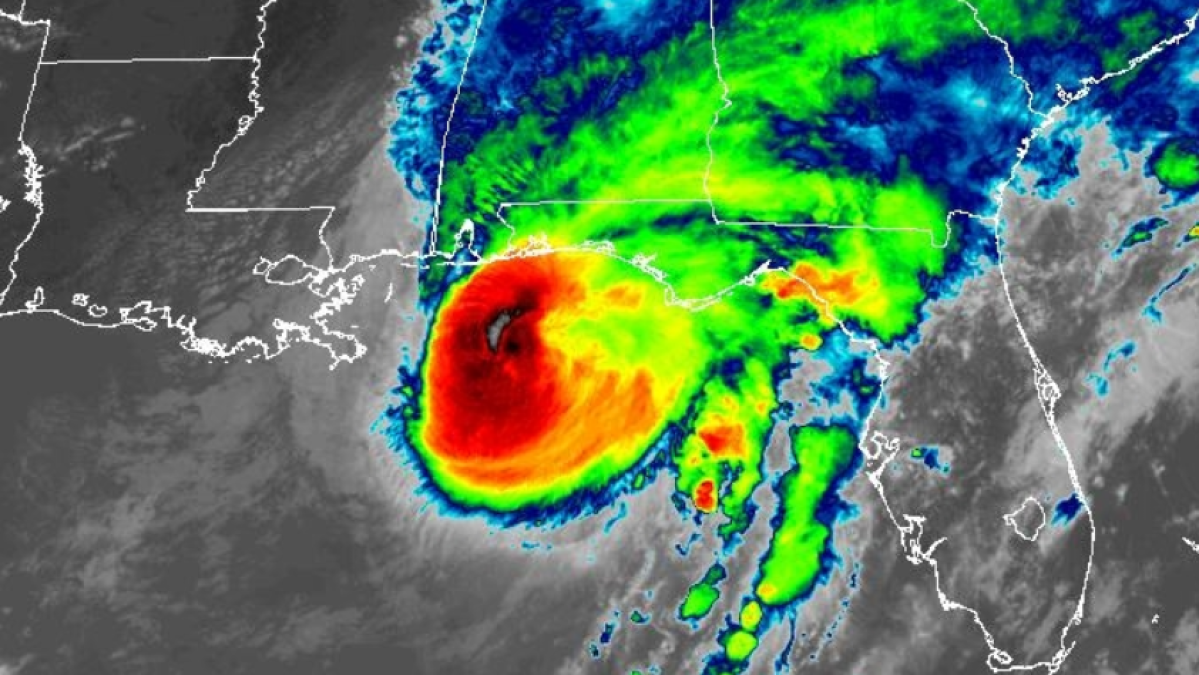
Hurricane Isaías Hits Florida as Category 2 Storm, Telemundo Miami Reports
Hurricane Isaías made landfall in the northwest coast of Florida as a Category 2 storm, packing maximum sustained winds of 105 mph and bringing life-threatening conditions, Telemundo Miami reported. The National Hurricane Center confirmed the impact after the system weakened from earlier peak winds of 120 mph when it was classified as a Category 3 storm.
Storm Surge Hits Florida Panhandle as Isaías Ties Record
Water levels rose rapidly across the Florida Panhandle as the storm pushed inland. In Panama City Beach, a monitoring station recorded a storm surge reaching 5.4 feet above normal high-tide levels. Meanwhile, Pensacola registered a peak wind gust of 102 mph alongside sustained winds of 62 mph.
Before making landfall, Isaías tied a 121-year-old record by forming late in the Atlantic hurricane season, matching a benchmark set on October 8, 1905, according to sources. Meteorologists attributed the delayed storm formation to a strong El Niño climate pattern that kept ocean temperatures and atmospheric dynamics unseasonably subdued during the early months of the season.
Governors Declare Emergencies as Oil Production Halts
Governors across Florida and Alabama declared states of emergency to mobilize resources ahead of the impact. In Florida, Governor Ron DeSantis mobilized approximately 5,000 members of the National Guard across more than a dozen affected counties, as reported by sources. Evacuation orders were issued for vulnerable coastal communities from Mississippi to the Florida Panhandle.
The energy sector also felt the disruption as the storm churned through the Gulf of Mexico. Offshore operators suspended production at several platforms, halting roughly 511,000 barrels of oil per day, according to sources.

Widespread Rain, Wind, and Inland Threates
Communities far beyond the immediate coastline braced for severe weather as the system advanced. Sources outlined warnings for the Atlanta metropolitan area, where the National Weather Service projected prolonged wind gusts between 30 and 40 mph, heavy rainfall, localized flash flooding, and isolated tornadoes extending from Friday night through Sunday morning.
Univision coverage from Pensacola highlighted the dangerous combination of torrential rain, destructive winds, and potential tornadoes threatening residents throughout the Florida Panhandle, Alabama, and Mississippi. Emergency management agencies urged residents in evacuation zones to remain in safe shelters and avoid flooded roadways as recovery operations prepare to begin once conditions allow first responders to deploy.
More on Hurricane Isaías
Related reading
- Quebec Court Authorizes Class-Action Lawsuit Over Alleged Sexual Assaults at Nordik Spa
- California Faces Medi-Cal Reckoning Amid Rising Costs and Expected Federal Cuts
- Apple Cuts iPhone 18 Pro Production Due to Low Demand, GSMArena Reports (newsdirectory3.com)
- Isaias Came Within Hours of 1905's Latest-First-Hurricane Record (daybreakwire.com)