How to Track Wildfires and Road Closures on Google Maps and Other Apps
Holiday Gridlock Collides With Emergency Fire Zones
Navigation platforms, including Google Maps, and official channels like the Directorate-General for Traffic (DGT) have activated real-time mapping tools to help drivers track active blazes, avoid restricted corridors, and reroute safely around emergency zones.
Automated Crisis Alerts on Consumer Mapping Apps
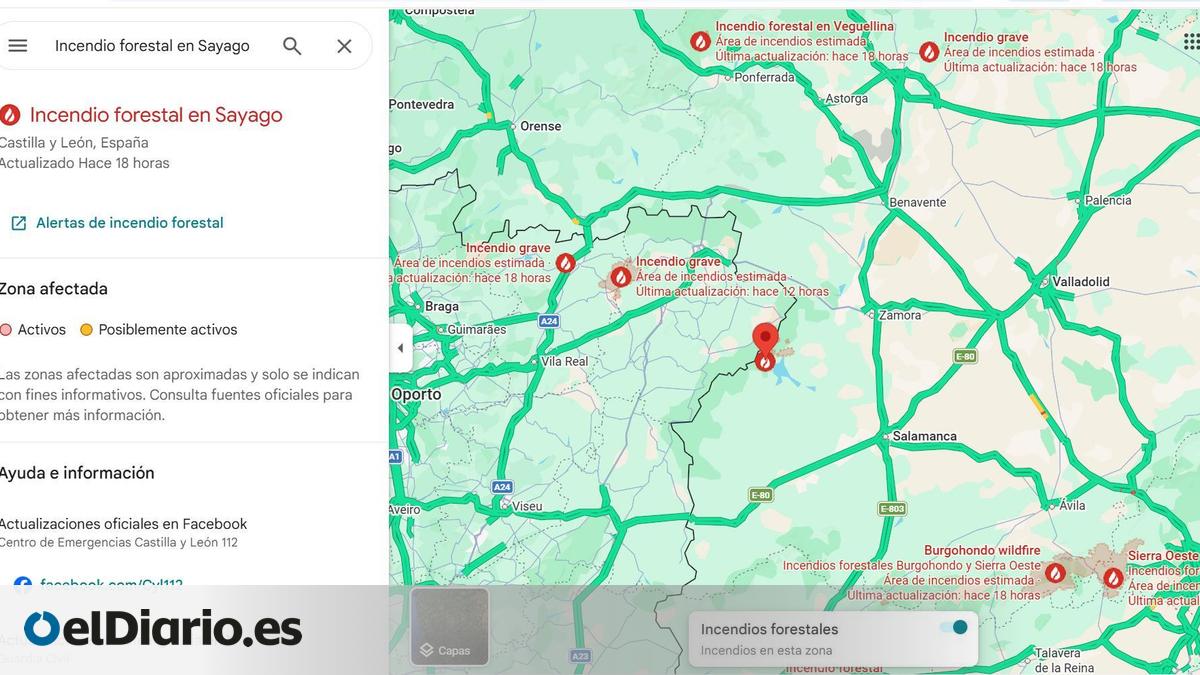
Google Maps has integrated automated crisis alert architecture designed to flag active environmental hazards, including wildfires, floods, and severe storms. According to platform updates, these warnings trigger automatically when a user searches for an impacted area or when a mapped route intersects an emergency zone.
Tapping an active warning opens a detailed data card featuring safety recommendations, news updates, and official bulletins sourced from regional authorities. Drivers can also manually inspect broader regions by enabling the dedicated wildfire overlay within the application settings or by executing targeted queries for specific fire incidents.
Satellite Telemetry and Thermal Mapping Limitations
Visual representations on the platform rely on satellite telemetry and artificial intelligence models developed to detect thermal and vegetation shifts nearly in real time. Red icons and boundary outlines designate active fire perimeters, while yellow highlights indicate adjacent zones with reduced activity levels. Platform developers emphasize that satellite approximations can vary by several kilometers from ground-level realities, making compliance with local civil protection directives mandatory.
National Transit Regulators and Digital Corridor Tracking
Beyond consumer mapping platforms, national transit regulators provide dedicated infrastructure tracking. According to the Directorate-General for Traffic (DGT), interactive digital maps incorporate a specialized wildfire layer that displays blocked roadways, mandatory detours, and active traffic restrictions alongside standard updates on roadwork and accidents.
This oversight is vital for rural and mountainous routes where shifting wind patterns can force authorities to shut down transport networks with minimal advance notice. For individuals and businesses attempting to maintain logistics or complete holiday transits, consulting verified public transit portals prevents vehicles from becoming trapped in rapidly evolving danger zones.
Collaborative Portals and Specialized Commercial Oversight
Complementary mapping initiatives, such as the regional tracking portal incendiosespaña.es, aggregate active hotspots onto collaborative mapping interfaces. Transportation officials emphasize that while digital tools offer valuable route planning assistance, drivers must prioritize real-time instructions issued by emergency services and law enforcement agencies over automated navigation prompts.
When regional infrastructure is heavily compromised and travel schedules face severe disruption, securing professional oversight becomes essential.
As seasonal fire conditions continue to test transport resilience across the country, travelers must maintain vigilance, cross-reference multiple digital and official data streams, and remain prepared to alter itineraries instantly as emergency conditions dictate.