
A previously unknown fault line has been discovered near Brzegi, in southern Poland, revealing evidence of powerful earthquakes that occurred thousands of years ago in a region currently considered seismically stable. The discovery, made by a team led by Dr. Piotr Kłapyta of Jagiellonian University in Krakow, centers around a distinct, two-mile-long scarp – a sharp rise in the ground – that runs across pastures.
Dr. Kłapyta, a geomorphologist, and his colleagues initially investigated the scarp to determine if it was the result of water erosion or landslides. However, their investigations revealed signs of deeper geological breakage, leading them to identify a previously undocumented fault. Airborne laser mapping confirmed the scarp’s straight and continuous nature, a characteristic rarely seen in formations created by typical erosion processes. Geophysical surveys further corroborated the findings, detecting a sharp discontinuity beneath the visible edge.
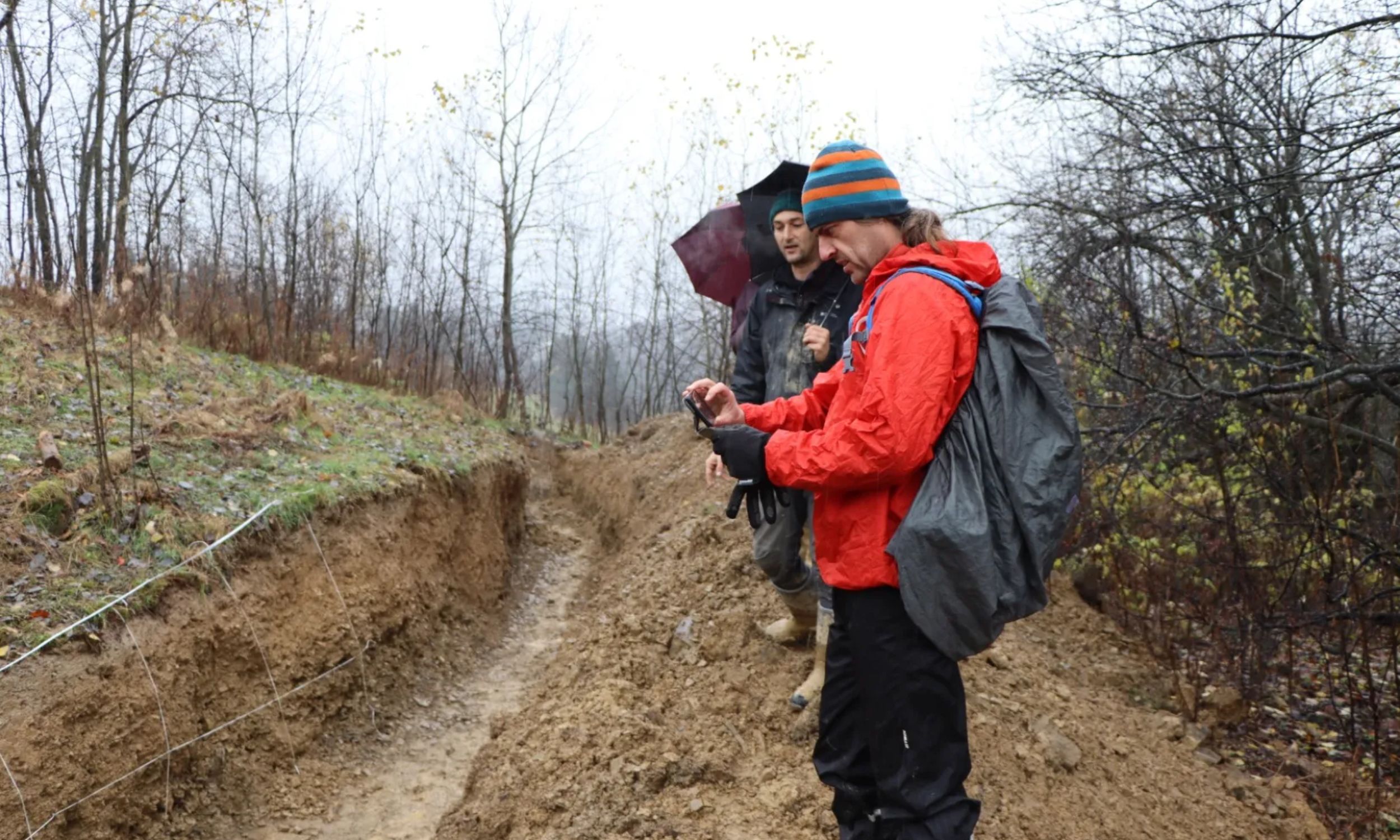
Excavations along the scarp uncovered a paleoseismic trench, exposing sediment layers that were abruptly disrupted and resumed at different levels, confirming the presence of a fault zone. Analysis of the trench walls revealed sharp breaks and smeared bands indicative of shearing forces, rather than gradual soil slumping. While the trench cannot provide a complete record of past seismic activity, it definitively demonstrates that sudden ground movement occurred in the area.
Researchers estimate the rupture occurred between 10,000 and 50,000 years ago, during the last ice age, using diffusion modeling to assess the age of the landscape feature. The Brzegi fault is unusual in that its relatively short length – approximately 3 kilometers (nearly 2 miles) – appears disproportionate to the size of the surface break, which reaches up to 4 meters (13 feet) in height. This challenges the typical correlation between fault length and the magnitude of surface displacement.
The discovery is significant because current seismic maps classify the Podhale basin, where Brzegi is located, as a low-risk zone. However, the limited historical record of seismological data for the region means that longer-term seismic activity may have been underestimated. The fault’s movement appears to have been both sideways and downward, aligning with regional tectonic pressures stemming from the collision of the Alps and the Carpathian Mountains. Researchers from the University of Silesia, the AGH University of Science and Technology, the University of Wrocław, and the University of Jena collaborated on the research, which was published in the journal Geomorphology.
The Brzegi fault line serves as a reminder that the ground can retain evidence of past earthquakes long after the shaking has ceased. Scientists are now utilizing high-resolution mapping techniques to identify similar features in other valleys, with plans for further trenching and more precise dating to assess the frequency of past ruptures and refine seismic hazard assessments for the region. The findings underscore the importance of paleoseismic studies in providing a more comprehensive understanding of geological hazards than relying solely on contemporary earthquake catalogs.