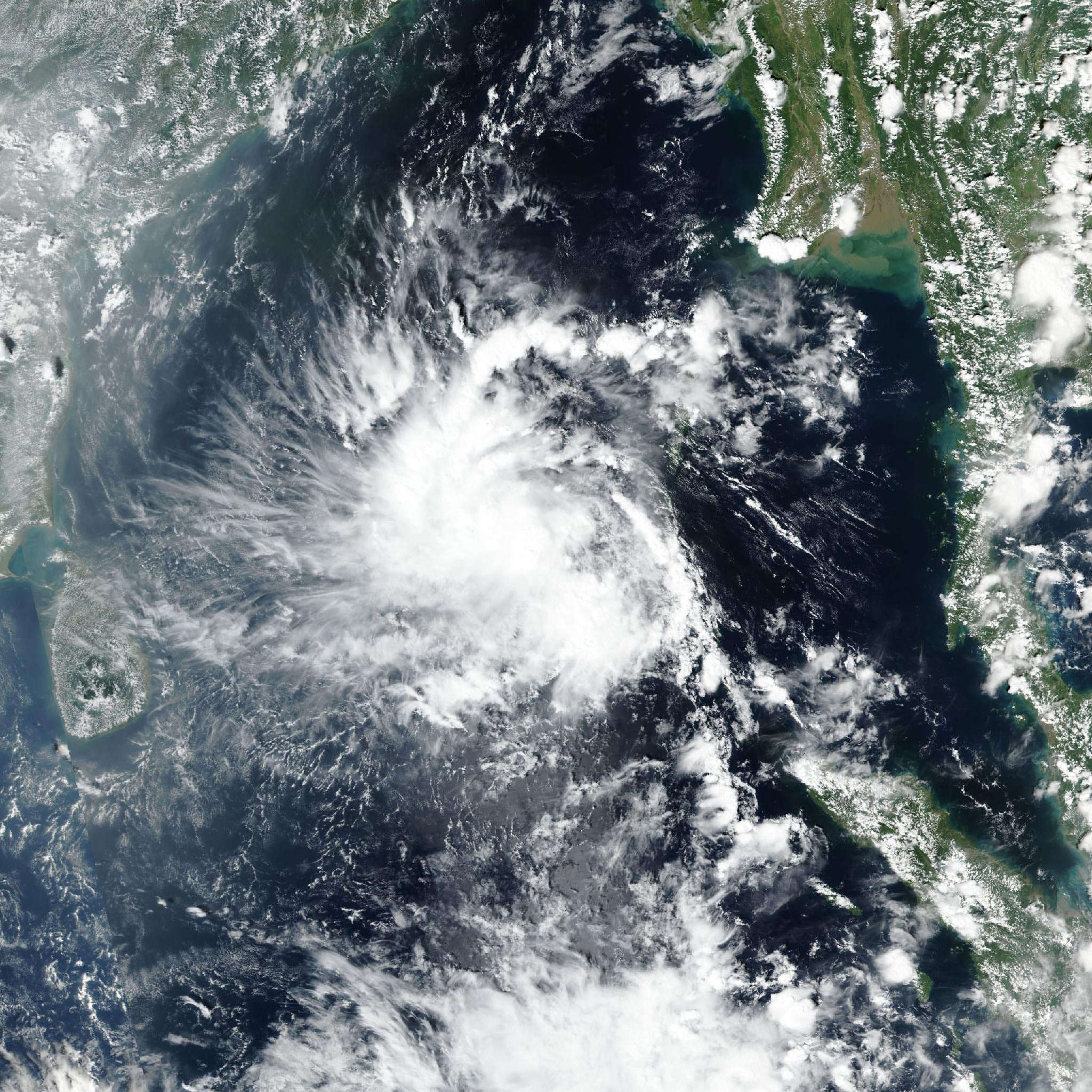
Cyclonic Storm 04B: JTWC reports high track and low intensity confidence
Cyclonic Storm 04B Moves Toward Eastern India
Cyclonic Storm 04B is currently located 1,237 kilometers south of Kolkata, India, and has tracked west-northwestward at 19 kilometers per hour over the past six hours. Maximum significant wave height near the system is 4 meters (13 feet). Guided by a subtropical ridge positioned to its northeast, the system is projected to move toward the northwest for the entirety of the forecast duration. Track speed will slow as it approaches eastern India, with landfall expected in 36 to 48 hours as the vortex interacts with local terrain.
The Tech TL;DR:
- 04B sits 1,237 km south of Kolkata, moving west-northwest at 19 km/h with 4-meter maximum wave heights.
- Landfall is projected within 36 to 48 hours, preceded by a peak intensity of 95 km/h (50 knots) in the next 24 to 36 hours.
- Model guidance shows a 157 km cross-track spread at landfall, with the JTWC official forecast assessed at high track confidence and low intensity confidence.
Intensity Models Diverge on Peak Wind Speeds
As favorable environmental conditions persist and the system continues consolidating, 04B is anticipated to strengthen over the next 24 to 36 hours, reaching a maximum intensity of 95 km/h (50 knots). After this point, it will sharply weaken once it makes landfall and terrain interaction deteriorates the vortex. Intensity model guidance shows significant spread among platforms. COAMPS-TC, HWRF, and Decay-SHIPS depict peaks of 100 to 120 km/h (55 to 65 knots) at 36 hours, while the GFS model shows only 75 km/h (40 knots) at that interval.

A rapid intensification aid has populated, though it is not explicitly depicted in the official forecast. Models agree on sharp weakening and dissipation following landfall but retain a 35 km/h (20 knots) spread due to differing forecast peaks. The official Joint Typhoon Warning Center intensity forecast is assessed with low confidence, maintaining good agreement with the multi-model consensus.
Track Models Agree on Landfall Timing
| Model / Agency | Peak Intensity Forecast | Timeline to Peak / Landfall | Dissipation Timeline |
|---|---|---|---|
| COAMPS-TC | 100–120 km/h (55–65 knots) | 36 hours | Standard post-landfall |
| HWRF | 100–120 km/h (55–65 knots) | 36 hours | Standard post-landfall |
| Decay-SHIPS | 100–120 km/h (55–65 knots) | 36 hours | 60+ hours (slowest) |
| GFS | 75 km/h (40 knots) | 36 hours | Standard post-landfall |
| JTWC Official | 95 km/h (50 knots) | 24 to 36 hours | Before 3 days |
Track model guidance demonstrates good agreement throughout the forecast period, showing a 157-kilometer cross-track spread at the time of landfall. After landfall, the majority of models slow in track speed and show a slight westward turn. The official JTWC forecast track is assessed with high confidence, matching both multi-model and AI consensus metrics. Among the platforms, 04B is projected by most models to break down in 60 hours, whereas the Decay-SHIPS models take the longest to indicate dissipation at 3 days. The forecast is thus extended out over the next 3 days to allow for possible slower dissipation, given Decay-SHIPS skill in landfall forecasting, though the official JTWC shows dissipation occurring before 3 days due to its higher peak assessment.
# CLI diagnostic check for tracking data ingestion
curl -s https://api.zoomearth.com/v1/storms/04B/track
  | jq '.current_position, .velocity_knots, .wave_height_meters'