
Cyclonic Storm 02A: LIVE Tracker, Updates & Forecast
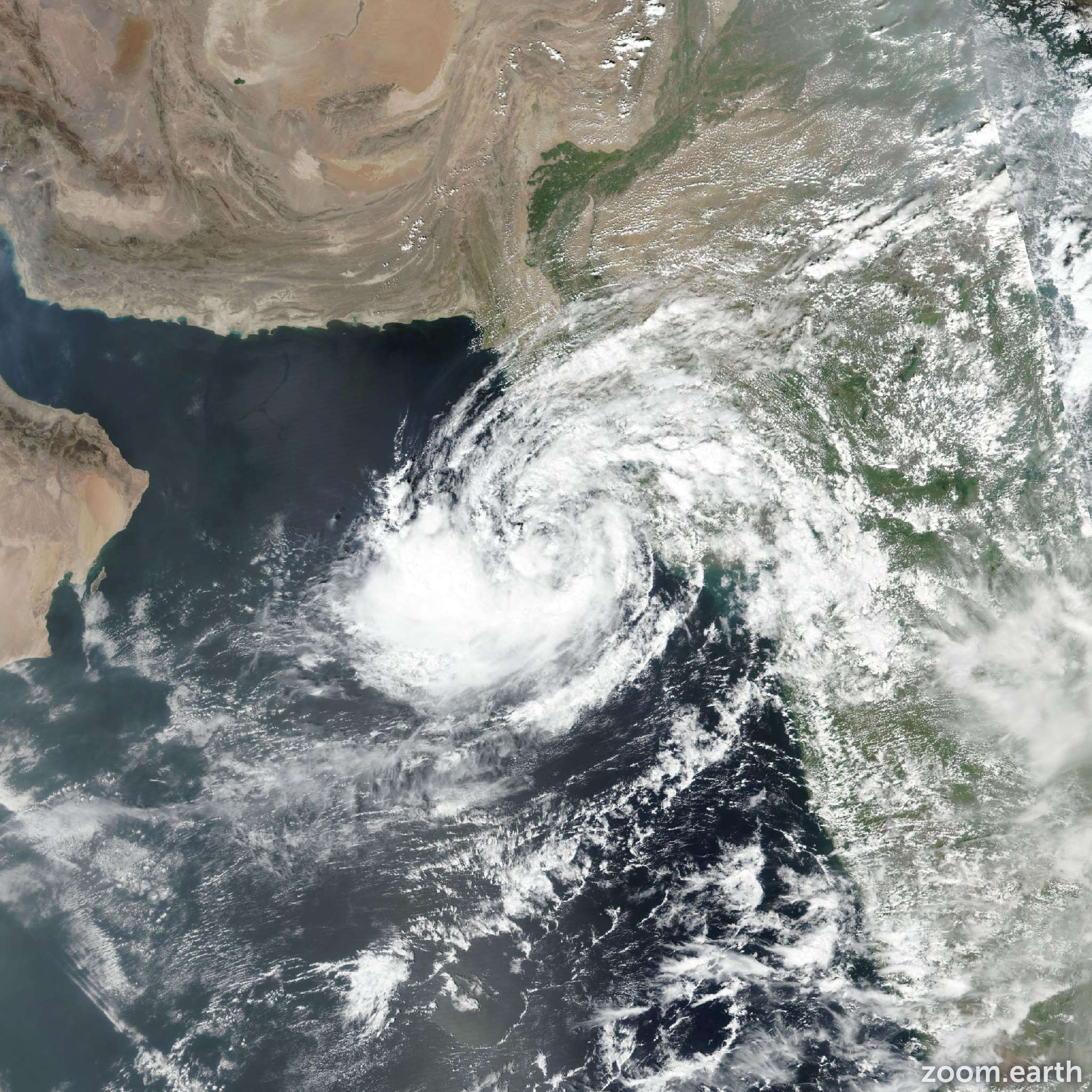
As of the latest update, Cyclonic Storm 02A is located 367 kilometers (228 miles) south of Karachi, pakistan, and has been moving west-northwestward at 6 kilometers per hour (3 knots) over the past six hours.Notable wave heights are currently reaching 4 meters (13 feet).
The storm is forecast to continue on a generally westward to west-southwestward path for the next two days, steered by a subtropical ridge of high pressure to the north. Beyond that timeframe, a developing shortwave trough to the north is expected to weaken this steering ridge. This will shift the dominant steering influence to ridging positioned south and east of the cyclone, initiating a turn in its trajectory.
This change in steering patterns is predicted to reverse the storm’s motion, guiding it east-northeastward towards the west coast of India. However, the approaching shortwave trough will also introduce increasing wind shear and draw in drier air, factors expected to cause steady weakening. Current forecasts anticipate the system will dissipate to below a warning-level intensity of 65 kilometers per hour (35 knots) before any potential landfall.
Numerical weather models largely agree on this overall scenario,predicting westward to west-southwestward movement for the next 2-3 days,followed by a turn to the east.Though, there is some divergence regarding the speed of the westward track and how sharply the storm will curve back eastward.
solutions based on the GFS and UKMET models align closely with the current forecast track. Conversely, the ECMWF deterministic model and its ensemble mean suggest a more westward track, with the system likely dissipating over water before reaching India. The range of possibilities within the ensemble model members covers the spectrum between these two projections.
Regarding intensity, model guidance is more consistent.The storm is expected to intensify steadily to rapidly in the near term,benefiting from low vertical wind shear and favorable upper-level outflow. Though, the introduction of unfavorable conditions after two days will lead to rapid weakening and eventual dissipation.