
New Satellite Images Reveal Earth’s Hidden Secrets
A recently launched satellite is already delivering stunning images, offering unprecedented views of our planet’s forests and extreme environments. This innovative mission promises a groundbreaking leap in our understanding of Earth’s ecosystems, aiding in crucial climate change research and resource management.
Spectacular First Images
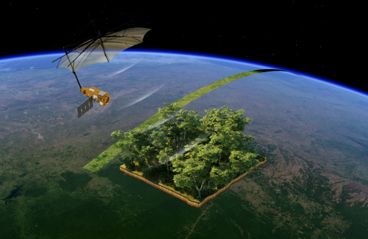
The Biomass satellite, part of the European Space Agency’s FutureEO program, has begun its work. Even though commissioning is ongoing, the initial images are impressive. The satellite’s advanced radar technology penetrates dense vegetation to measure woody biomass—trunks, branches, and stems—providing insights into carbon storage.
Check out the latest images from the Biomass satellite, revealing the beauty of our planet from space! 🛰️ #Biomass #EarthObservation example.com
“As is routine, we’re still in the commissioning phase, fine-tuning the satellite to ensure it delivers the highest quality data for scientists to accurately determine how much carbon is stored in the world’s forests.”
—Michael Fehringer, ESA’s Biomass Project Manager
Deforestation, particularly in areas like Bolivia, is a major concern, with primary forest loss ranking high globally. Biomass will help monitor these changes and provide valuable data for conservation efforts. In 2023 alone, the world lost 3.75 million hectares of forest, an area larger than the size of Switzerland (Global Forest Watch).
Unveiling Hidden Landscapes
The satellite’s radar can also penetrate sand up to five meters, allowing the study of sub-surface geological features in deserts. This opens avenues for understanding past climates and locating fossil water resources. Furthermore, the radar’s long wavelength offers insights into ice velocity and internal structure, which is not easily achievable by shorter wavelength radars.
The mission’s goal is to accurately quantify forest carbon stocks. Scientists can better understand the role of tropical forests in the global carbon cycle by combining multiple observations of the same area to reveal forest height and biomass.