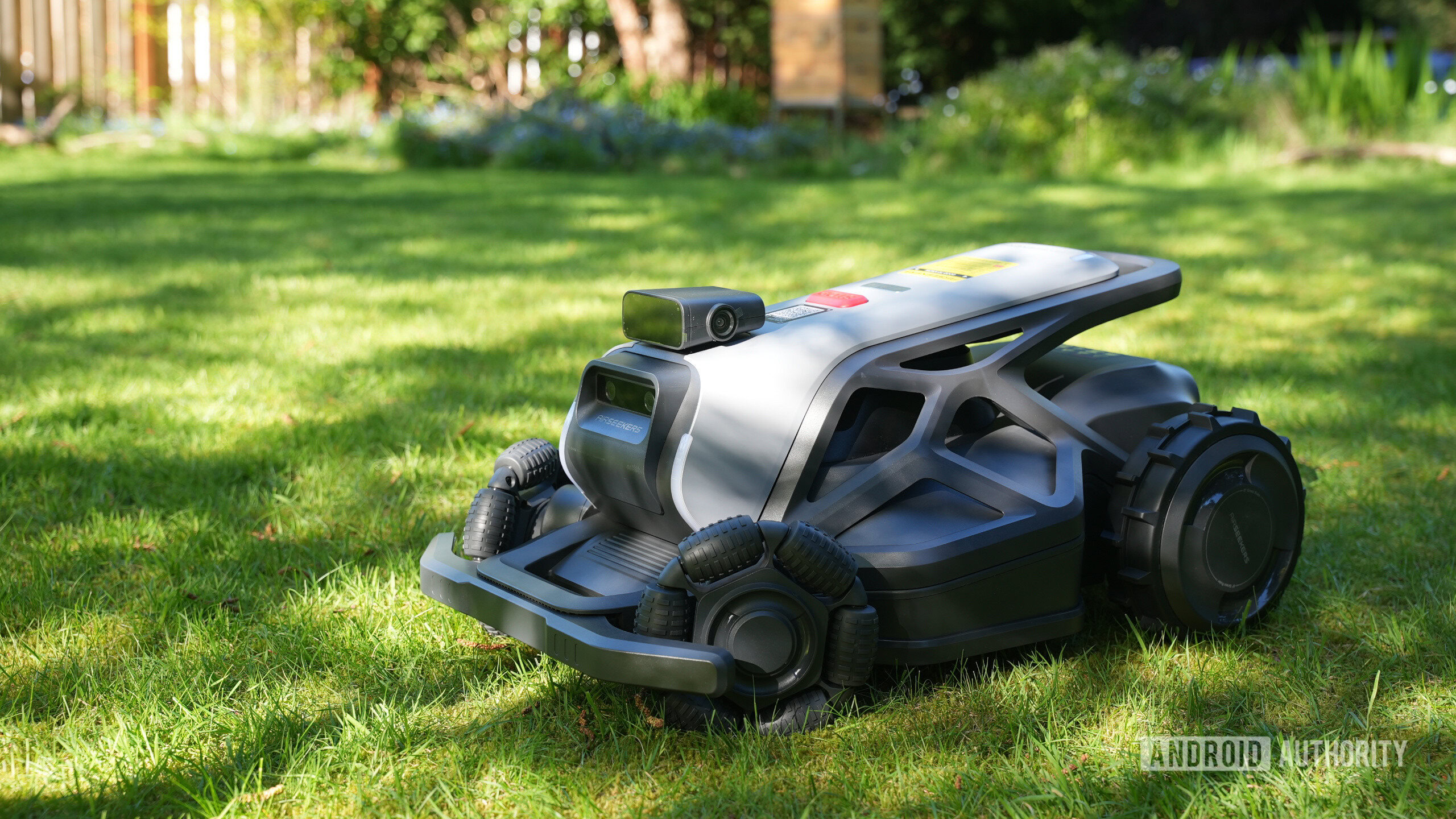
Airseekers Tron Review: A Sci-Fi Robot Mower With a Few Flaws
The Airseekers Tron is a high-end robotic mulching mower utilizing Real-Time Kinematic (RTK) satellite navigation to achieve centimeter-level precision without perimeter wires. While the hardware features a rugged, tank-like chassis and a dual-blade mulching system, deployment is hindered by a non-localized US app and RTK signal attenuation caused by canopy cover, according to reporting from Android Headlines.
The Tech TL;DR:
- Hardware: Dual-blade system for mulching; IPX6 weather resistance; 15Ah battery (Tron) vs 10Ah (Tron SE).
- Navigation: RTK-based GPS replaces LiDAR or boundary wires but requires clear sky-view for the antenna.
- Bottlenecks: Lack of US imperial localization in the app and missing RTK antenna mounting hardware.
However, the reliance on RTK introduces a specific failure point: signal occlusion. Unlike LiDAR-based systems that map environments via light pulses, RTK requires a constant link to a base station and satellites. When trees or buildings obstruct this line of sight, navigation drift occurs. This architectural choice creates a deployment bottleneck for users with dense foliage, necessitating precise antenna placement to avoid operational latency.
Hardware Specifications and Performance Benchmarks
Airseekers, founded in 2022, has bifurcated its product line into the flagship Tron and the entry-level Tron SE. The primary differentiator is the power envelope and subsequent area coverage. According to Android Headlines, the Tron can process 0.6 acres (approximately 26,000 square feet) per 24-hour cycle, while the Tron SE is capped at 0.44 acres (19,000 square feet).
| Specification | Airseekers Tron | Airseekers Tron SE |
|---|---|---|
| Battery Capacity | 15Ah | 10Ah |
| Charging Current | 7A | 5A |
| Daily Coverage | 0.6 Acres | 0.44 Acres |
| Navigation | RTK-GPS | RTK-GPS |
| Build Rating | IPX6 | IPX6 |
The chassis is designed for high-torque, all-terrain movement, featuring segmented front wheels to prevent turf damage in wet conditions. The cutting assembly employs a dual-blade configuration: a primary disk for the initial cut and a secondary set of blades positioned above the disk to mulch clippings back into the soil. This mechanical approach reduces the need for bag emptying but requires consistent blade maintenance to prevent clogging.
The RTK Deployment Bottleneck
The transition from LiDAR to RTK navigation alters the installation workflow. RTK (Real-Time Kinematic) enhances standard GPS accuracy to the centimeter level by calculating the difference between a fixed base station and the rover (the mower). Per the GPS World technical standards, RTK is highly sensitive to “multipath” errors—where signals bounce off structures—and atmospheric interference.
Android Headlines reports a significant friction point in the out-of-box experience: Airseekers provides a trident for ground-staking the antenna but fails to include a mounting arm. This forces users to manually find a location devoid of shade, as tree canopies disrupt the satellite lock.
Furthermore, the software stack lacks basic localization for the North American market. The application remains locked to metric measurements, forcing US users to manually convert square meters to square feet.
Implementation: Testing RTK Signal Strength
While the Tron is a closed system, similar RTK modules typically output data that can be analyzed for “Fix” vs “Float” status. A “Fix” indicates centimeter precision, while a “Float” indicates the system is still converging, leading to navigation errors.

# Example: Filtering NMEA GNGGA sentences to check GPS quality
# $GNGGA indicates Global Navigation Satellite System Fix Data
cat /dev/ttyUSB0 | grep "$GNGGA" | awk -F',' '{print "Time: " $1 " | Quality: " $6 " | Satellites: " $7}'
Competitive Landscape: RTK vs. LiDAR
The Tron competes in a market split between boundary-wire, LiDAR, and RTK systems. LiDAR (Light Detection and Ranging) creates a local map using laser pulses, making it superior in areas with heavy tree cover but often more computationally expensive. RTK is more efficient for wide-open spaces but fails under a canopy. According to Ars Technica‘s coverage of autonomous robotics, the industry is trending toward “sensor fusion”—combining RTK with LiDAR and computer vision to eliminate the weaknesses of any single system.
The Tron’s current lack of integration with Apple Find My or Google Find Hub limits its utility as a connected IoT device, leaving it as a standalone tool rather than a part of a broader smart-home ecosystem.
Disclaimer: The technical analyses and security protocols detailed in this article are for informational purposes only. Always consult with certified IT and cybersecurity professionals before altering enterprise networks or handling sensitive data.