
## Curiosity Investigates Ancient Chemistry on Mount Sharp
Earth planning date: Friday, Sept. 5, 2025
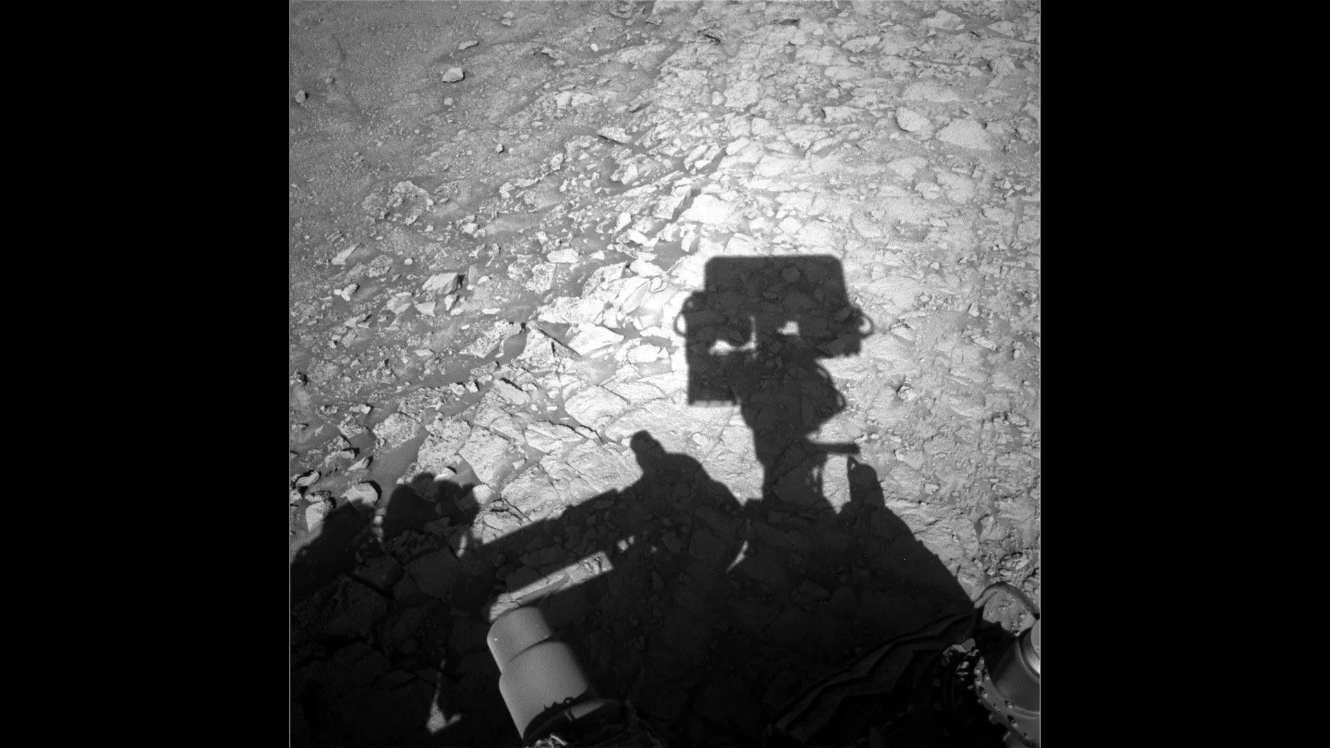
Teh Curiosity rover is currently engaged in a detailed examination of a unique landscape on Mount Sharp – a region characterized by striking boxwork ridges and intervening hollows. Scientists believe these formations hold clues to past environmental conditions, perhaps revealing how fluids interacted with the bedrock and sculpted this terrain over millions of years. The leading hypothesis suggests the ridges formed through mineral cementation, with softer material later eroded to create the hollows.
This week, the team focused on understanding the subtle variations within this boxwork environment.A key objective was to characterize the transition between the smoother, more consolidated bedrock found on the crests of the ridges and the more fragmented, nodular bedrock exposed at the edges of the shallow hollows. These differences could indicate variations in the cementing process or subsequent weathering patterns.
Early in the week, Curiosity utilized its suite of remote sensing instruments – MAHLI, Mastcam, and ChemCam – to analyze the smoother ridge bedrock, gathering detailed textural data and compositional facts. A carefully planned maneuver then positioned the rover to examine the nodular bedrock bordering a nearby hollow.A similar observational sequence was repeated on Friday, concentrating on the newly accessible target. The next planned drive will move Curiosity towards another boxwork ridge, bringing the rover closer to potential drill sites.
As the APXS (Alpha Particle X-ray Spectrometer) strategic planner, I played a critical role in selecting rock targets for compositional analysis. Safety was paramount, ensuring the instrument could make contact without risk, while also prioritizing targets that would best address the scientific goals of the boxwork campaign. I then disseminated the APXS results to the wider team, interpreting the data in the context of the overall investigation and contributing to the ongoing debate about the optimal location for a future drill sample.
Beyond the immediate focus on boxwork,curiosity continued to document the broader geological context.Long-range imaging with Mastcam and ChemCam captured views of distant ridges, hollows, buttes, the yardang field, and the rim of Gale Crater. Routine environmental monitoring, using instruments like REMS, RAD, and DAN, continued to track atmospheric dust, dust devil activity, and cloud formations.
Written by Lucy Thompson, Planetary Scientist and APXS Team Member, University of New Brunswick, canada.