Tropical Storm Polo triggers flash floods across Mountain West and Plains
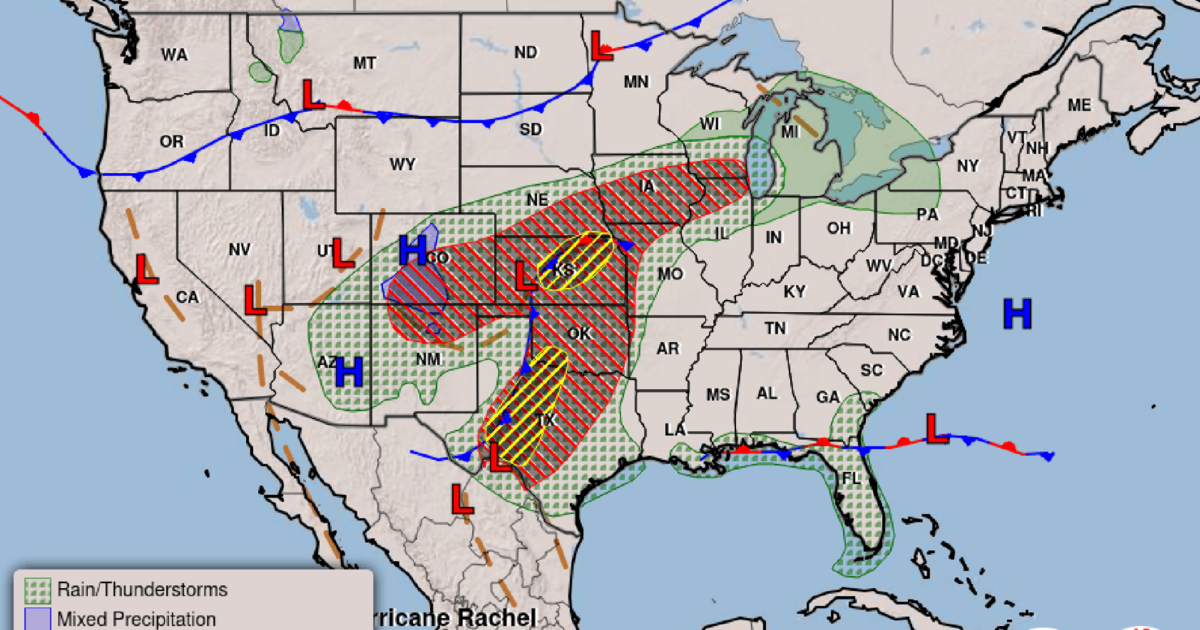
As Hurricane Polo transitions into a tropical storm and combines with a western low-pressure system, 48 hours of heavy rain across New Mexico, Arizona, Texas, Oklahoma, and Colorado have shifted immediate danger from falling water to hazardous runoff, swollen rivers, and active flash flood warnings.
Flash Flood Warnings and Rising River Levels Across New Mexico
The immediate danger from the system has shifted toward heavy runoff following 48 hours of relentless rainfall across the region. Carter Greulich, a meteorologist with the National Weather Service in Albuquerque, stated that the state sits on the back end of a storm system tied to Tropical Storm Polo alongside an incoming low-pressure system from the west. Northern New Mexico remains under a flood watch through midnight along and north of the Interstate 40 corridor. Forecasters project an additional 1 to 2 inches of rain widely, with isolated totals reaching 3 to 4 inches possible at higher elevations. This sustained precipitation continues to fuel flash flooding and swell regional waterways, including the Pecos River east of Santa Fe, which triggered a river flood warning.
Geographic Scope Across the Mountain West and Plains
While the storm initially changed course to drop heavy rain on parts of west Texas and Oklahoma, its merger with secondary systems broadens the impact zone. Communities across the Mountain West face continued wet weather through Thursday. Flood watches extend across northern New Mexico, central Oklahoma, western Kansas, and southern and eastern portions of Colorado. Meanwhile, small pockets of New Mexico and Arizona remain under active flood warnings.
Mudslide Risks and Recovery Challenges in Southern New Mexico
Steep mountain slopes in northern New Mexico face a small but nonzero possibility of mudslides or landslides. Farther south, flood warnings highlight inundated roads along New Mexico State Road 246 west of Roswell and into Lincoln County near Ruidoso. Saturated burn scars near Ruidoso remain a distinct concern if localized storms pass overhead, though Greulich characterized that specific threat as low-confidence rather than impossible. In Eddy County, including Artesia, already flooded roads stay closed as standing water requires time to drain even with minimal additional rainfall expected.

Long-Term Weather Outlook and Infrastructure Impact
Beyond Wednesday, New Mexico and neighboring regions look mostly dry heading into early or midweek next week, though scattered showers and thunderstorms could return. Greulich noted that rainfall projections for those upcoming systems remain non-concerning. For communities coping with standing floodwater, however, the forecast offers no instant reset. Water must fully recede before impacts ease and damages can be calculated.