Tropical Storm Lala Batters Hawaii With Flooding and Power Outages
As of August 16, 2026, Tropical Storm Lala continues to impact the Hawaiian Islands, causing widespread power outages for over 129,700 customers and at least one confirmed fatality. The storm, which previously reached Category 1 hurricane intensity, is currently delivering heavy rainfall and damaging wind gusts across the archipelago.
Infrastructure Collapse and Utility Disruptions
The transition of Lala from a hurricane to a tropical storm has not mitigated the threat to Hawaii’s electrical grid. According to data from PowerOutage.us, more than 129,700 utility customers remain without power as of Sunday morning. Hawaii County accounts for the majority of these outages, where falling trees and debris have severed lines across multiple districts. Governor Josh Green confirmed that at least three hospitals are currently operating on generator power to maintain essential services.
The physical toll on infrastructure is significant. Residents in the path of the storm are facing extended recovery timelines as utility crews navigate blocked roads.
Rainfall Totals and Flash Flood Emergencies
The Big Island has borne the brunt of the meteorological impact. Since Friday, rainfall totals have been extreme, with the community of Laupahoehoe on the Hamakua Coast recording more than 33 inches of rain, according to ABC News. The National Weather Service (NWS) previously issued a life-threatening flash flood emergency for communities including Naalehu, Pahala, and Hawaiian Ocean View, where rainfall rates reached 3 to 5 inches per hour at the height of the storm.
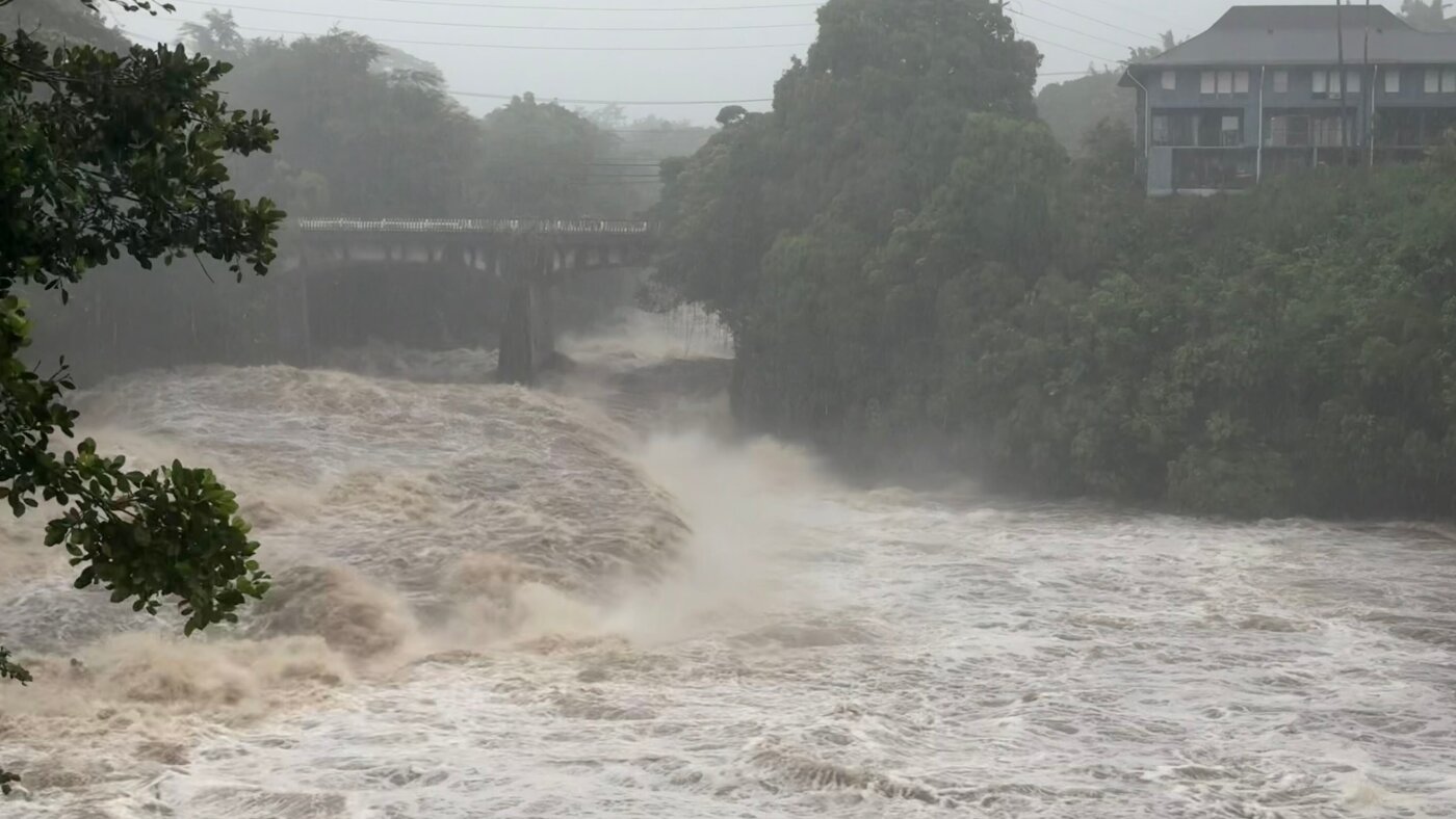
The environmental risk remains high as soil saturation levels hit critical points. “What makes this very challenging is that there’s rushing water, there’s debris, and there’s boulders on the road and it’s dark,” Hawaii County Mayor Kimo Alameda stated regarding the ongoing search-and-rescue efforts in the southern tip of the island.
Regional Economic and Transit Impacts
Beyond the immediate threat to life and property, the storm has paralyzed regional transit. Over 200 flights were canceled on Saturday, and cruise line itineraries have been significantly disrupted. The closure of major transit arteries, including segments of the Mamalahoa Highway, has complicated logistics for local businesses and emergency responders.

Long-Term Vulnerability and Future Risks
While the storm is moving westward away from the Big Island, tropical storm warnings remain in effect for Maui, Molokai, Lanai, Kahoolawe, Oahu, Kauai, and Niihau. Forecasters expect the storm to maintain tropical-storm-force winds while potentially regaining hurricane strength by midweek once it clears the island chain. The mountainous terrain of the islands complicates wind forecasting; the National Hurricane Center noted that wind speeds atop peaks and on slopes can be up to 30% stronger than near-surface measurements.
The state’s reliance on “off-the-grid” housing in certain rural areas creates unique hazards during high-wind events. As officials continue to assess the damage—including the loss of at least 19 roofs and multiple homes swept away by floodwaters—the focus shifts from immediate survival to long-term stabilization.
The path to recovery for the Big Island and the surrounding region will be measured in months, not days. Staying informed through official channels remains the most effective defense against the unpredictable nature of tropical weather patterns in the Pacific.