
First Alert Weather Day Declared for Monday as Storm System approaches East Texas
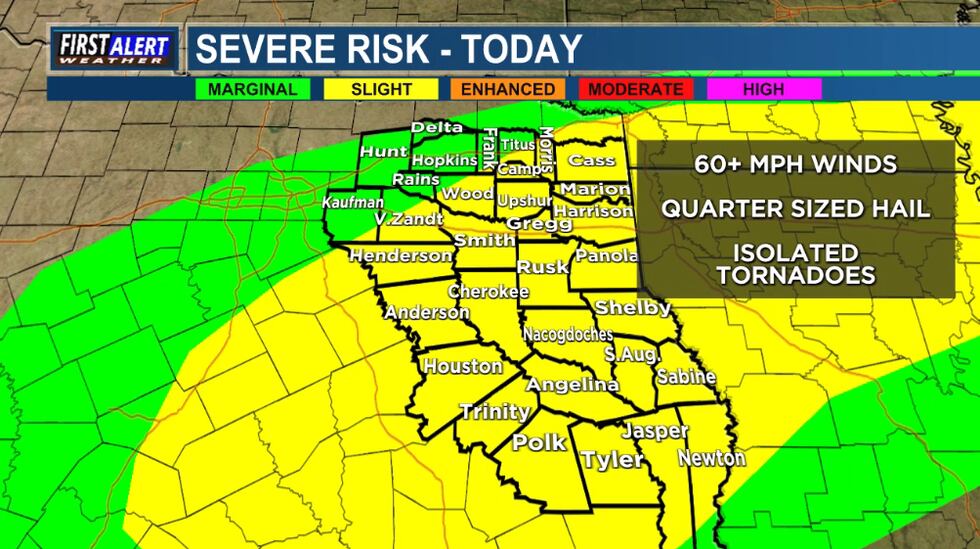
Tyler, Texas – November 24, 2025 - KLTV has declared Monday a First Alert weather Day as a critically important storm system is forecast to bring severe weather to East Texas. Residents should prepare for the possibility of strong thunderstorms,damaging winds,and large hail. The Storm Prediction Center has outlined a portion of the region in a Level 3 of 5 risk for severe thunderstorms on Monday.
This system, developing across the Southern Plains, will move eastward, impacting East Texas throughout the day Monday. The primary threats include damaging wind gusts possibly exceeding 60 mph, large hail up to the size of golf balls, and localized flooding. While the risk of tornadoes appears lower, it cannot be entirely ruled out. KLTV’s weather team will provide continuous updates throughout the event, beginning with First Alert forecasts on KLTV News at 6 and 10 tonight.
the highest risk for severe weather will be between 10:00 AM and 6:00 PM Monday. Areas along and north of Highway 84 are under the greatest threat. Residents are urged to secure outdoor objects, have a plan for seeking shelter, and stay informed through KLTV and its digital platforms. the seven-day forecast indicates clearing conditions by Tuesday, with temperatures returning to seasonal averages.