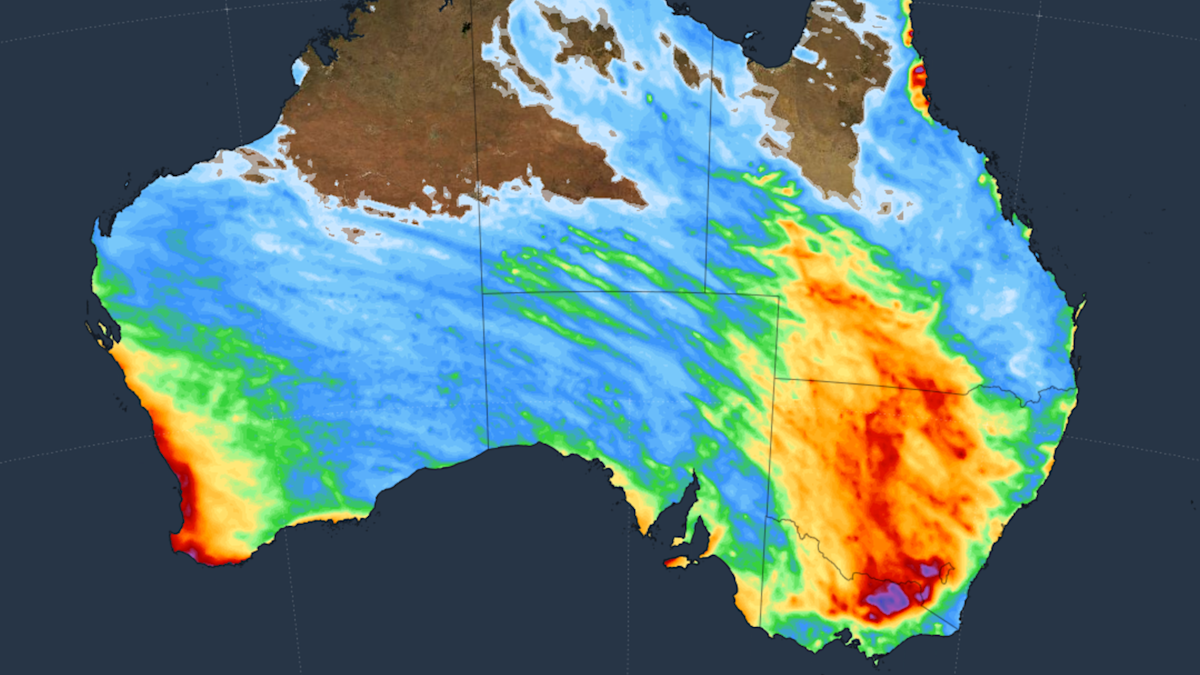
Multiple Rainbands to Bring Much-Needed Rain to Australia
Multiple rainbands are forecast to sweep across Australia over the coming week, signaling a significant shift in weather patterns following a notably dry start to the winter season. Meteorologists expect the incoming systems to bring widespread precipitation to the east coast, while the west coast faces a separate, intense weather event to conclude the week.
Rainfall outlook for eastern Australia
Communities across eastern Australia, including parts of Victoria, are bracing for a period of unsettled weather as several rainbands move across the country. According to reports from the Australian Broadcasting Corporation and Weatherzone, these systems are expected to deliver much-needed moisture to regions that have experienced limited rainfall since the beginning of winter. The forecast indicates that while the rain will improve ground moisture, it will also create unfavorable conditions for those in alpine regions, as warmer temperatures and precipitation threaten existing snow cover.

Impacts on the western coastline
While the east prepares for a drenching, the west coast of Australia is contending with a more immediate and volatile weather front. Sky News Australia reports that the region is bracing for a “wet and wild” conclusion to the week, characterized by stronger winds and heavier showers. This contrast in weather activity highlights a split in the national climate pattern, with forecasters tracking multiple distinct fronts that are expected to influence different states simultaneously throughout the coming days.
Comparing regional forecasts
The current meteorological data indicates a divergence in how these systems will manifest. While eastern regions are anticipating a steady, broad-reaching arrival of rainbands, the western states face a more concentrated, high-energy event. Weatherzone has confirmed that these multiple bands are tracking across the continent in rapid succession, marking a departure from the stagnant, dry conditions that characterized the early weeks of the winter season. Infrastructure and emergency services in the affected states remain on alert as the Bureau of Meteorology continues to monitor the movement of these fronts.