
“`html
Hidden Landscapes: Revealing the Topography Beneath Continent-Sized Ice Sheets
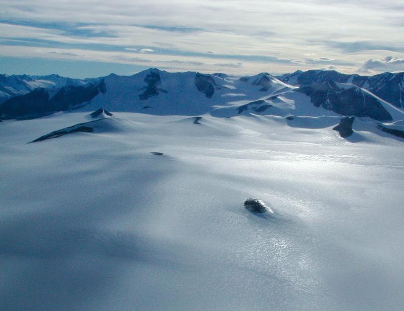
For decades, scientists have understood that the bedrock beneath massive ice sheets isn’t a smooth, flat surface. However, the extent and complexity of this hidden topography remained largely unknown. Recent advancements in radar technology and data analysis are now providing unprecedented detail about the mesoscale topographical variability – features ranging from kilometers to hundreds of kilometers in size – lurking beneath ice sheets like those covering greenland and Antarctica. This revelation has meaningful implications for understanding ice sheet stability, predicting future sea level rise, and refining models of glacial flow.
Why Mapping the Bedrock Matters
The shape of the bedrock profoundly influences how ice flows. Valleys, ridges, and other topographical features act as pathways or obstacles, directing and accelerating or slowing down the movement of ice. accurate knowledge of this underlying landscape is crucial for:
- Predicting Ice Sheet Behavior: Understanding how ice interacts with bedrock topography allows for more accurate predictions of ice sheet dynamics, including flow rates and potential for collapse.
- Improving Sea Level Rise Projections: More precise models of ice sheet behavior translate directly into more reliable projections of future sea level rise, a critical concern for coastal communities worldwide.
- Understanding Past Glacial Activity: Bedrock topography provides clues about the history of ice sheet growth and retreat, offering insights into past climate conditions.
New Technologies unveiling Hidden Details
Traditionally, mapping the bedrock beneath ice sheets was a challenging endeavor. However, several technological advancements are revolutionizing this field:
- Ice-Penetrating Radar: Radar systems, often deployed from aircraft, send radio waves through the ice and measure the time it takes for them to reflect off the bedrock. This data is then used to create detailed topographical maps. Newer, more powerful radar systems can penetrate thicker ice and provide higher-resolution images.
- Gravity and Magnetic Surveys: These techniques measure variations in the EarthS gravitational and magnetic fields, which can reveal data about the density and composition of the bedrock.
- Advanced Data processing: Sophisticated algorithms and computational power are essential for processing the vast amounts of data collected by these technologies and creating accurate topographical maps.
Recent research, published in Nature geoscience,details the use of these techniques to map a previously unknown network of valleys beneath the West Antarctic ice Sheet. This discovery highlights the potential for uncovering even more hidden features.
Key Findings and Surprising Discoveries
Recent studies have revealed several surprising aspects of the bedrock topography beneath ice sheets:
“We’re finding that the bedrock is far more complex than we previously thought. There are deep, incised valleys, large ridges, and even potential subglacial lakes hidden beneath the ice.” – Dr. Dustin Schroeder, University of Texas at Austin (Source: University of Texas News)
- Extensive Valley Networks: Many regions exhibit extensive networks of valleys, suggesting significant erosion by past glacial activity.
- Subglacial Lakes: Depressions in the bedrock often contain subglacial lakes, bodies of liquid water that can influence ice sheet dynamics.
- Unexpected Bedrock Highs: Researchers have discovered previously unknown bedrock highs – elevated areas that can impede ice flow.
Implications for Ice Sheet Stability
The newly revealed topographical features have significant implications for ice sheet stability. such as, valleys can act as conduits for warm ocean water to reach the base of the ice sheet, accelerating melting. Bedrock highs can create stress points,potentially leading to fracturing and increased ice flow. Understanding these interactions is crucial for predicting how ice sheets will respond to future climate change.
Future Research and Ongoing Efforts
The exploration of subglacial topography is an ongoing process. Future research will focus on:
- Higher Resolution Mapping: Developing even more advanced radar systems and data processing techniques to create even more detailed topographical maps.
- Integrating Topography with Ice Flow Models: Incorporating the new topographical data into sophisticated ice flow models to improve predictions of ice sheet behavior.
- Investigating Subglacial Hydrology: Studying the network of sub