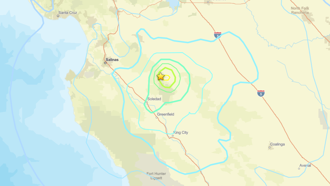
Magnitude 5.0 Earthquake Strikes Near Pinnacles National Park, Revised From 5.1
Near Pinnacles National Park and the city of Soledad, a magnitude 5.0 earthquake hit Central California late Thursday night, November 19, causing light tremors in nearby areas.
The United States Geological Survey listed the earthquake at 10:49 p.m. local time on Thursday, November 19. The federal agency initially recorded the earthquake at magnitude 5.4 before lowering its estimate to 5.1 and subsequently revising it to 5.0. The epicenter sat about 6.2 miles northwest of Pinnacles National Park in San Benito County, originating at a depth of approximately 6.7 kilometers, or 4.16 miles, beneath the surface.
Shaking reached surrounding communities including Marina, where residents reported feeling the movement. Authorities reported no immediate injuries or major structural damage, and they did not expect a tsunami after the earthquake.
Seismologists registered a series of smaller tremors both before and after the main shock. Two foreshocks preceded the event: a magnitude 3.1 tremor at 9:53 p.m. and a magnitude 3.3 tremor at 10:12 p.m.

| Time (Thursday) | Magnitude |
|---|---|
| 10:52 p.m. | 3.0 |
| 10:57 p.m. | 2.5 |
| 10:58 p.m. | 2.5 |
| 11:14 p.m. | 3.4 |
| 11:19 p.m. | 2.6 |
| 11:21 p.m. | 2.7 |
At least one resident in Marina received a notification through the USGS ShakeAlert system and felt the shaking. The automated warning advised people to drop, cover, and hold on if the shaking intensified.
The system is designed to detect earthquakes after they begin and transmit warnings to areas where potentially damaging seismic waves have not yet arrived. The earthquake occurred near the San Andreas fault, one of California’s primary geological fault systems, though authorities had not immediately determined which specific fault was responsible for the sequence.
Pinnacles National Park sits about five miles east of Soledad in Central California, its distinctive rock formations the eroded remnants of an extinct volcano that has traveled roughly 200 miles north along the San Andreas Fault from its original location. The area was first protected as a national monument by President Theodore Roosevelt in 1908 and became a national park in 2013.
Regional data shows that two additional tremors of over magnitude 3.0 had taken place within about 100 miles of the location over the prior seven days.
Keep reading
- Pedestrian Seriously Injured in Flieden Crosswalk Crash; Police Debunk Death Rumors
- UN Scales Up Accountability as 500 Peacekeeper Paternity Claims Remain Unresolved
- Hércules Strikes as Fluminense Beats São Paulo 1-0 (archyde.com)
- Europe Responds to Trump Putin Talks as Russia Strikes Ukraine (newsy-today.com)