
Tsunami Wave Captured From Space for the First Time
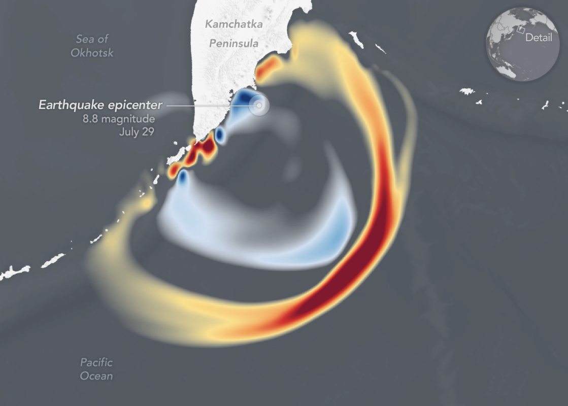
WASHINGTON D.C. – In a landmark achievement for disaster monitoring, a tsunami triggered by an 8.8-magnitude earthquake off RussiaS Kamchatka Peninsula on July 30th was captured in unprecedented detail by the Surface Water and Ocean Topography (SWOT) satellite.This marks the first time a tsunami has been observed from space, providing scientists with a new outlook on these potentially devastating natural events.
The data, recently published in The Seismic Record, offers a thorough view of the wave’s height, shape, and direction, extending across a 120-kilometer swath of ocean surface with high-resolution accuracy. Previously, tsunami monitoring relied on sparse data from point-measurement buoys like DARTs and limited cross-sectional views from other satellites.
“I think of SWOT data as a new pair of glasses,” explained Angel Ruiz-Angulo of the University of Iceland. “Before, with DARTs we could only see the tsunami at specific points in the vastness of the ocean. There have been other satellites before, but they only see a thin line across a tsunami in the best-case scenario.Now, with SWOT, we can capture a swath up to about 120 kilometers wide, with unprecedented high-resolution data of the sea surface.”
While the earthquake and resulting tsunami fortunately caused only insignificant damage, the event provided a crucial opportunity to validate and refine tsunami forecasting models. NASA officials highlighted the potential for this breakthrough to improve future tsunami warnings and protect coastal communities.
“Data from SWOT provided a multidimensional look at the leading edge of the tsunami wave triggered by the Kamchatka earthquake,” NASA stated.”By providing data on the wave’s height, shape, and direction, SWOT is helping scientists improve tsunami forecast models and protect coastal communities.”