Chocolate Hills: Color-Changing Mounds & Giant Legends of Bohol
The chocolate Hills: A unique Geological Formation
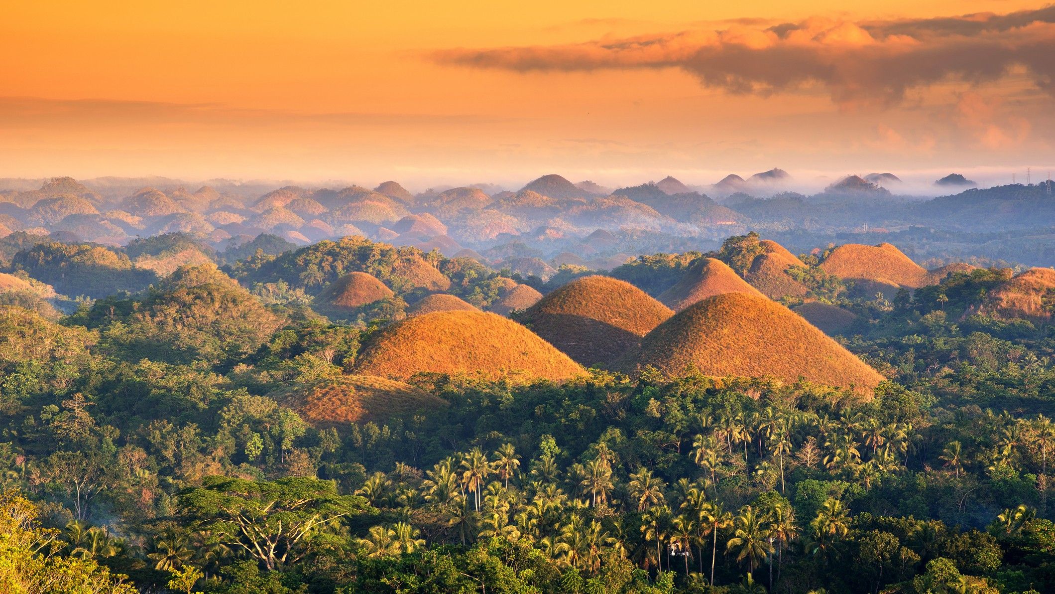
The Chocolate Hills, located in Bohol, Philippines, are a remarkable geological formation consisting of roughly 1,776 symmetrical, cone-shaped hills spread across a 38 square kilometer (15 square mile) area. They get their name from the dry season, between November adn May, when the grass covering the hills turns cocoa brown.
Geological Origins & Characteristics:
* National Monument: Designated a national geological monument in 1988 and a natural monument in 1997.
* Unique Formation: While a similar, though less impressive, geological formation exists in Java, indonesia, the Chocolate Hills are otherwise unique in the world.
* Mogotes: The hills are examples of “mogotes” – steep-sided mounds found in tropical karst landscapes (areas with soluble bedrock, sinkholes, and cave systems).
* Height: They range in height from 100 to 390 feet (30 to 120 meters) and have tapering tops.
* Underground Features: Numerous underground caverns and springs have been documented, with potential caves existing beneath the hills themselves.
* Formation Timeline: Evidence suggests they formed during or just before the last ice age (2.6 million to 11,700 years ago) through tectonic uplift of coral and marine deposits, followed by erosion from rainfall.
Local Lore:
Local myths attempt to explain the hills’ creation. Two popular legends include:
* A mud-throwing fight between two giants.
* The remnants of mud cakes baked by giant children under coconut shells.
Land Use & Conservation:
The land surrounding the hills is used for agriculture, primarily rice cultivation. the declaration of the Chocolate Hills as a natural monument in the late 1990s initially faced resistance from local farmers, miners, and landowners.