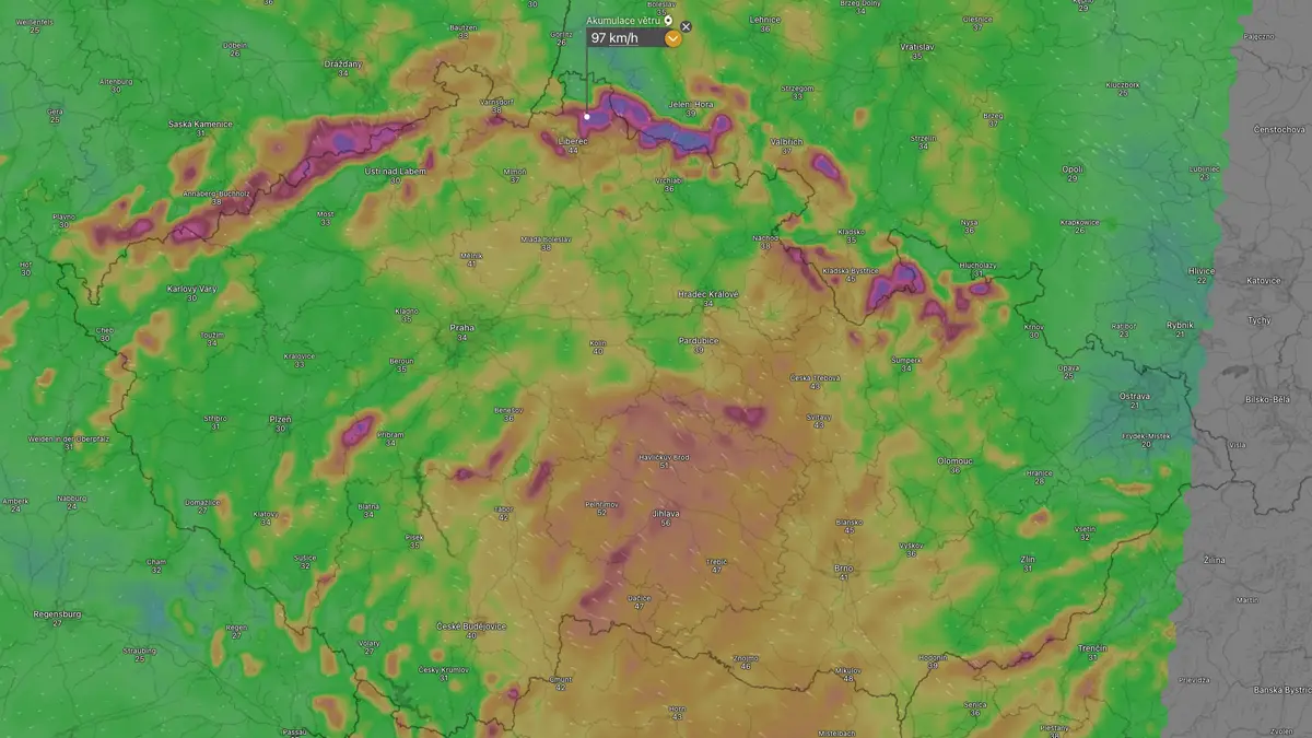
CHMU Forecasts 100 km/h Wind Gusts for Northern Mountain Ranges
Residents in the Jizera Mountains and the Frydlant region should prepare for wind gusts reaching approximately 65 km/h, with some mountainous areas potentially seeing gusts up to 100 km/h.
Regional Impact and Safety Protocols
Meteorologists expect the southeasterly winds to intensify throughout Wednesday. The alert specifically targets the northern border mountain ranges, where exposed ridges are at the highest risk. While the Jizera Mountains and the Frydlant protrusion are currently identified as the primary zones for 65 km/h gusts, atmospheric models indicate that more severe pokes could hit 100 km/h in isolated, high-altitude locations. The Bohemian-Moravian Highlands are also expected to face elevated wind activity during this period.
The CHMU advises the public to exercise heightened caution when outdoors or operating vehicles. For those planning outdoor activities, the recommendation is clear: avoid ridge trails and high-altitude hiking paths until the weather system passes. The combination of high wind speeds and terrain topography creates a significant hazard for hikers and motorists alike.

Infrastructure and Economic Vulnerability
High-velocity wind events of this magnitude frequently strain regional infrastructure. The energy sector, forestry management, and transportation networks are particularly susceptible to damage. Power distribution systems may face localized outages if branches or trees fall onto lines, a common occurrence during high-wind events in forested regions like northern Bohemia.
Timeline for Atmospheric Stabilization
The wind event is not expected to persist through the work week. According to the current forecast, the strong southeasterly winds will begin a gradual decline starting Thursday. By Friday, conditions are projected to stabilize significantly, with wind speeds dropping to a manageable 4 m/s. In some areas, the transition may lead to near-calm conditions.
This rapid shift from high-velocity gusts to relative calm highlights the transient nature of the current weather front. The meteorological data suggests that while the intensity will drop by Friday, the cleanup phase for local municipalities and utility providers often begins only after the winds fully subside.
Managing Post-Storm Hazards
As the region moves into the final phase of the alert, the focus shifts from immediate safety to damage assessment.
The brief but intense nature of this weather system shows why regional readiness is important.