
Severe Storms Possible in Austin Monday, Threatening Thanksgiving Travel
Austin, TX – A line of thunderstorms developing Sunday is forecast to bring the potential for damaging winds, large hail, and even tornadoes to the Austin area Monday, perhaps disrupting Thanksgiving travel plans.While the most significant threats are expected north and east of the city, residents should be prepared for hazardous weather conditions throughout the day.
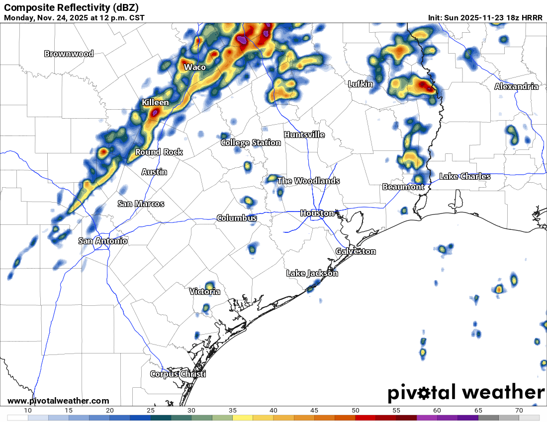
The storm system began forming between Wichita Falls and San Angelo and is predicted to move towards the Interstate 35 corridor early Monday.Morning commuters in Austin are likely to remain dry, but travelers heading north towards Dallas-fort Worth may encounter rain-related delays between 8 and 11 a.m. as the storm line pushes into the Metroplex.
The afternoon will see daytime heating combine with atmospheric instability, increasing the risk of severe storms. Highs are expected to reach the upper 70s and lower 80s, creating a warm and muggy environment conducive to storm development. A line of thunderstorms is anticipated to reach Austin between noon and 3 p.m., carrying the risk of damaging winds, large hail, and isolated tornadoes. The highest risk for severe weather, however, will be located north and east of Austin.
While the potential for strong storms should diminish by 5 p.m. as a cold front moves through, lingering showers are possible through 8 p.m., primarily east of Interstate 35.
The Storm Prediction Center indicates the risk of tornadoes is highest north and east of Austin, with supercells potentially capable of producing strong tornadoes. Damaging straight-line winds are also possible with any storm that develops, with gusts potentially exceeding 58 mph north of the Austin metro area. Large hail, an inch in diameter or larger, is also a concern, particularly north of the city.
A second, drier cold front is expected to arrive Tuesday into wednesday, ushering in considerably cooler and drier air. By Thursday morning, temperatures are forecast to be in the upper 30s to lower 40s.Despite abundant sunshine on Thanksgiving Day, afternoon highs are only expected to reach the upper 60s.