AI and Satellite Imagery Now Tracking Arctic Permafrost Thaw in Real Time
Scientists tracking the rapid destabilization of the Arctic landscape are leveraging artificial intelligence, historical aerial photographs, and high-resolution satellite imagery to map permafrost thaw in near-real time. According to research published by Anna Liljedahl and Ingmar Nitze, the monitoring framework tracks millions of thermokarst lakes and ponds across Alaska and the broader Arctic, providing critical infrastructure data as frozen ground collapses beneath roads, pipelines, and buildings.
The Mechanics of Sub-Surface Collapse and Thermokarst Formation
Permafrost is defined as ground that remains at or below 32 degrees Fahrenheit (0 degrees Celsius) for at least two consecutive years. Much of the sub-surface earth across Alaska and northern regions is rich with ice. As regional temperatures rise at two to three times the global average rate, that ice melts, causing the overlying ground to subside.
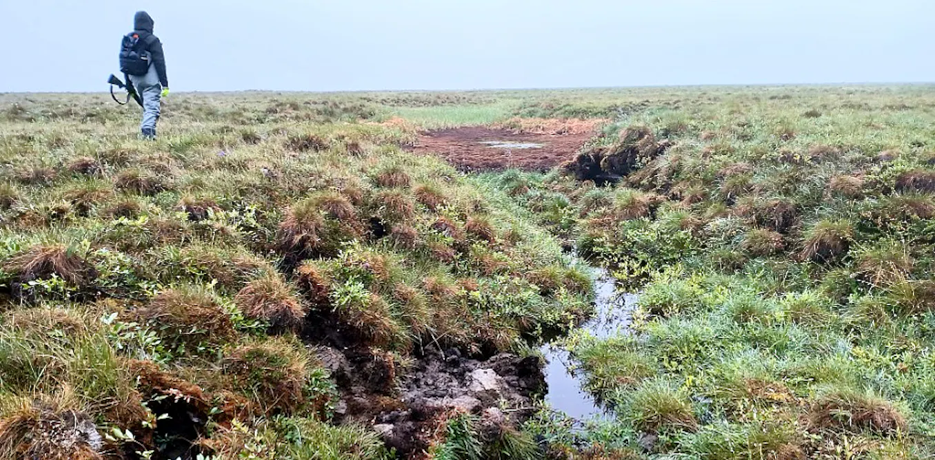
This physical shift mirrors the sinkhole activity seen in Florida. When ice-rich permafrost thaws, the ground surface drops to create depressions known as thermokarst ponds or trough ponds. These water-filled basins serve as visible markers of subterranean change, as direct measurement of permafrost requires invasive physical digging.
Researchers working through the international Permafrost Discovery Gateway utilize remote-sensing tools to monitor these features. Woodwell Climate Research Center secured a $5 million grant from Google.org in July 2023 to expand this open-access platform, incorporating sub-meter commercial satellite imagery to accelerate data processing.
AI-Driven Mapping Identifies Millions of Arctic Lakes
Analyzing expansive Arctic landscapes manually presents major logistical hurdles. To overcome this, remote-sensing researcher Chandi Witharana integrated artificial intelligence with historical data stretching back to the late 1940s aerial photography and 1970s satellite missions.
By deploying machine learning models against incoming satellite feeds, the international team currently maps and monitors over 4 million lakes across the Arctic. This includes approximately 70 million thermokarst trough ponds scattered across the Alaskan tundra. These digital products help distinguish ice-rich zones—which present high structural risks for engineering projects—from more stable, low-ice formations.
“Rapid tracking has historically been constrained by both remote-sensing technology and the pace of Arctic landscape change,” explains Anna Liljedahl regarding the necessity of automated geospatial workflows.
Abrupt Drainage Events Highlight 2026 Thaw Patterns
Not all permafrost indicators develop slowly. Thermokarst lakes that took a millennium to form can drain entirely within hours when thawing ground opens new subterranean drainage channels. These sudden events leave behind circular basins of bare, dry ground.

The Seward and Baldwin peninsulas in northwestern Alaska remain primary hot spots for abrupt drainage. Following an exceptionally warm winter in 2018, nearly 200 of the region’s 4,600 large lakes lost more than a quarter of their surface area. Data from June and July 2026 confirms that approximately 30 additional lakes in the same region experienced sudden drainage despite a relatively cold 2025–26 winter season.
Scientists caution that not every hydrological shift stems from permafrost degradation. Spring snowmelt and wildlife activity—such as beavers rebuilding dams across drainage channels—can temporarily alter water levels. Near-real-time satellite analytics allow researchers to isolate these variables.
Implications for Municipal Infrastructure and Community Planning
Historically, permafrost research findings trickled down to public view years after data collection through academic publications. Today’s near-real-time tracking provides actionable insights directly to northern communities facing rapid environmental displacement.
As remote-sensing models continue to refine pan-Arctic datasets, the integration of artificial intelligence with satellite monitoring establishes a baseline for managing climate risks in vulnerable northern territories.