
(CNN) — New images Satellites show drifting smoke about 965 kilometers from the wildfires burning California.
There are currently 26 major fire incidents in the state, according to Cal Fire. The biggest at the moment are the LNU and SCU Lightning Complex fires.
Those two fires, burning north and south of the Bay Area, are affecting approximately 91,499 hectares.
Smoke from the fires can be seen in the images satellite images taken on Wednesday. It appears that much of the smoke is being sucked into the Pacific Ocean.
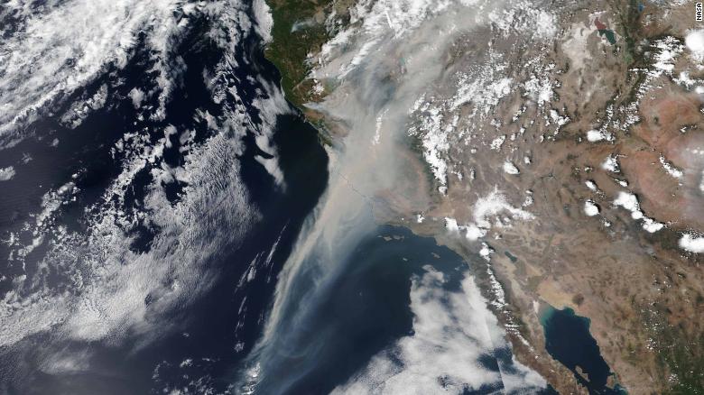
The smoke trail extends southwest off the California coast. Satellite images taken by NOAA also show smoke billowing from California into the Pacific.
Residents of parts of Lake and Napa counties were informed that there was an “immediate threat to life and property.” They were urged to evacuate as soon as possible, according to Cal Fire. Some Sonoma County residents were also asked to evacuate.
SATELLITE SPOTLIGHT: @NOAA‘s #GOES17????️ continues to track the extensive #smoke from the #wildfires across Northern California. This #GeoColor view shows the smoke blowing well away for the #fires, stretching hundreds of miles over the Pacific Ocean. #CAwx #CaliforniaWildfires pic.twitter.com/tjskieth8E
— NOAA Satellites – Public Affairs (@NOAASatellitePA) August 19, 2020
Today, California, as well as Montana, Idaho, Utah and Colorado, where other large fires are burning, are on red alert.
Smoke from the fires is causing air quality alerts in California’s San Joaquin Valley.

