
Severo-Kurilsk, Russia – A magnitude-8.8 earthquake struck off the Kamchatka Peninsula on Wednesday, triggering widespread tsunami warnings across the Pacific Ocean and prompting mass evacuations as far afield as Hawaii, Guam, and French Polynesia. While initial fears of catastrophic damage proved largely unfounded due to a swift international response, the port city of Severo-Kurilsk in Russia’s kuril Islands bore the brunt of the resulting tsunami.
The earthquake, which occurred at approximately 03:45 GMT on July 30, 2025, ranks among the most powerful seismic events ever recorded. The Pacific Tsunami Warning Center (PTWC) initially issued alerts for a vast area, including Japan, the Philippines, Indonesia, and coastal regions of the Americas. The epicenter was located approximately 200 kilometers (124 miles) east of the island of Paramushir, within the Kuril Islands chain.
The tsunami that impacted Severo-Kurilsk reached heights of up to 6 meters (nearly 20 feet), inundating the port and severely damaging the local fish processing plant, a key employer in the region. Footage broadcast by Russia’s Channel One showed extensive debris fields and partially submerged structures. The surge extended inland approximately 400 meters,reaching the city’s World War II memorial. Despite the earthquake’s magnitude, injuries reported where limited to minor cases, a testament to the effectiveness of early warning systems and evacuation protocols.
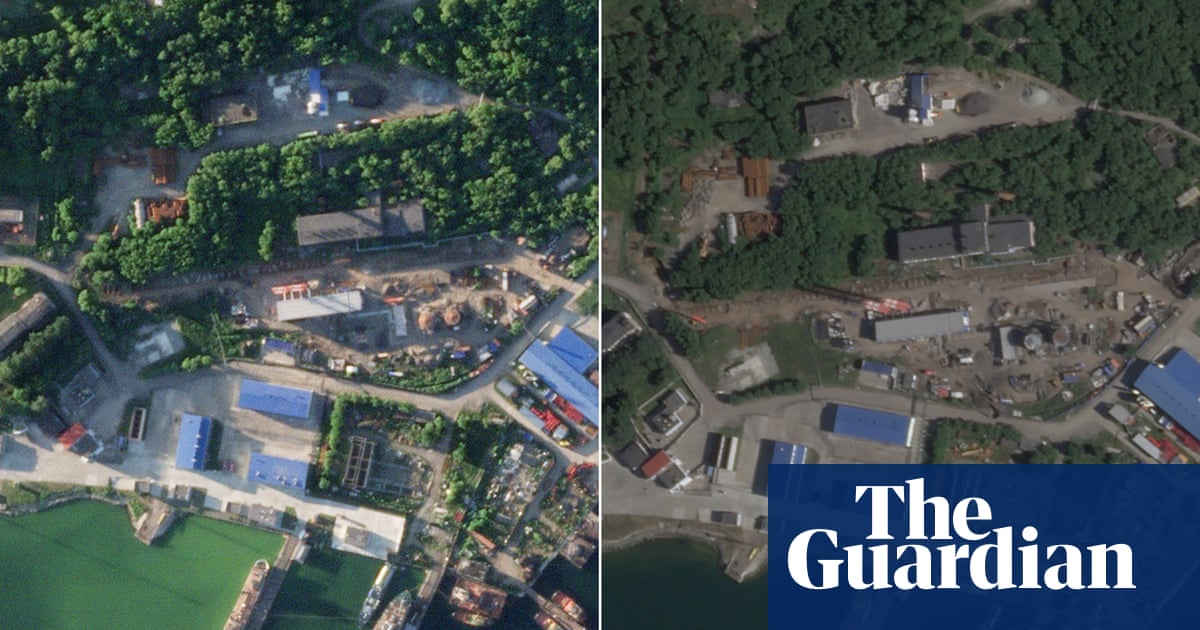
The Rybachiy submarine base, a critical facility for Russia’s Pacific Fleet located near Severo-Kurilsk, was closely monitored following the earthquake and tsunami. The base, which houses nuclear-powered submarines, underwent safety inspections, and no breaches or damage to nuclear facilities were reported by the Russian Ministry of Defense. The base’s role includes the maintenance and deployment of vessels such as the Project 971 Shchuka-B class (NATO designation: Akula I) submarines.
This event underscores the ongoing seismic activity in the Pacific “Ring of fire,” a region known for its frequent earthquakes and volcanic eruptions. The Kamchatka Peninsula, situated within this zone, experiences approximately 15% of the world’s earthquakes annually. The successful mitigation of widespread disaster, despite the earthquake’s immense power, highlights the growing sophistication of global disaster preparedness, including international data sharing, rapid alert dissemination via systems like NOAA’s Tsunami.gov, and coordinated evacuation plans. The 2011 Tohoku earthquake and tsunami in Japan, which resulted in nearly 20,000 fatalities, served as a crucial learning experience for international disaster response protocols.