
As of this Saturday, the threshold of hot weather (30 ° C) will be reached in the afternoon on two thirds southern of the country, to the Paris region. On the Pyrenees side, the thunderstorms will be there.
For your extended weekend of July 14, it is a very hot weather that is expected with sun, but also thunderstorms in the south of France. Aude and the Pyrénées-Orientales are placed on orange alert for thunderstorms. If we avoid the heat wave, it is an episode of strong heat that awaits us, announces The weather channel* .
As of Saturday, the threshold of heat (30 ° C) will be reached in the afternoon on two southern thirds of the country, to the Paris region. The handle of the English Channel will keep breathable heat with the wind that will come from the sea and limit the increase in temperatures. Sunday and Monday will be the two hottest days on a national scale. Afternoon temperatures will be between 30 and 35 ° C out of 80% of the territory. Temperatures will generally be between 25 and 30 ° C on our coasts.
Pass advertising
In addition to hot weather, we will closely monitor the stormy risk with An alert currently in place.
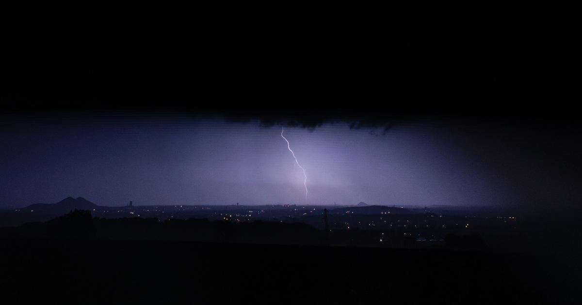
A very hot and sunny Saturday, departments placed on alert thunderstorms
Table of Contents
In the morning, the sun will dominate on 3/4 north of the country with temperatures generally between 15 and 20 ° C at daybreak. From the south of the Garonne to the Gulf of Lion, the sky will be divided between sun and clouds of unstable appearance.
From noon, Aude and the Pyrénées-Orientales are placed on orange alert for thunderstorms. The latter will be accompanied by intense rain, locally hail and gusts of wind. They will extend in the evening between the Gers and the Massif Central, before heading towards the Gard and the Bouches-du-Rhône in the night. Thirteen other departments are thus placed on a yellow alert: Ariège, Aveyron, Bouches-du-Rhône, Gard, Haute-Garonne, Gers, Hérault, Lozère, Pyrénées-Atlantiques, Hautes-Pyrénées, Tarn, Tarn-et-Garonne and Vaucluse.
Temperatures will reach 27 ° C in Lille and Strasbourg, will approach 30 ° C in Paris and Dijon, 31 ° C in Lyon, 33 ° C in Rennes and Limoges. There will only be 23 ° C in Biarritz and 25 ° C in Perpignan under the threat of stormy showers.
An even warmer Sunday
The weather will remain generally beautiful over a large northern half with a heat that will intensify compared to the day before. To the south, the atmosphere will remain a little heavy with an alternation of sun and budding cloudy. Localized thunderstorms will be able to burst between the Massif Central les Alpes and Corsica. Temperatures will be understood will reach or exceed 30 ° C in the afternoon on 3/4 of France.
Pass advertising
For the many fireworks that will be drawn in the municipalities of France in the evening of this Sunday, July 13, the weather conditions promise to be generally good with dry and hot weather. In the center-east, some thunderstorms can locally annoy the festivities.
A heavy Monday 14 July
Time will become more unstable for this Monday, July 14. After a calm and quickly hot morning with a generous sun, the clouds will bud in the afternoon and can be accompanied by scattered thunderstorms at the end of the day from southwest to northeast. Reliability is still limited to the activity, chronology and trajectory of thunderstorms.
Temperatures will drop on the western facade and the English Channel but will remain high elsewhere, often between 29 and 33 ° C in the afternoon.
*The weather channel is a property of the Le Figaro group.